Where do the PDA funds go now?

The future downtown station area will need some work. Image from City of San Rafael. Now that the Civic Center Priority Development Area (PDA) has been rescinded, TAM is left with a bucket of PDA-designated cash and even fewer places put it. While Mayor Gary Phillips says downtown San Rafael’s PDA is a logical place to put it, none of the proposed projects in the area are at a stage where they need funding.

Part of the delay is due to San Rafael Public Works (DPW) Director Nader Mansourian’s reported insistence that any road alterations wait until after SMART starts service in 2016. As a result, anything that might disrupt a road’s or intersection’s capacity, or level of service (LOS) will have to wait until the needed capacity is known. That includes bike lanes, traffic lights, crosswalks, bus lanes, etc.

PDA funds must be dedicated to improving the transportation infrastructure within a PDA. While they can target projects outside of a PDA, the project must have a direct positive effect on transportation service within the PDA.

It’s up to the Council and staff to get a slate of needed improvements to the area, from the small to the large. Some possible proposals:

Study which projects in the Downtown Station Area Plan would and would not impact traffic. This is probably the most basic study that would need to be conducted, given that it will be three years before SMART runs and likely another year beyond that before traffic patterns start to emerge. This would give a slate of small projects that could be priced, studied, and built before the train.

Link traffic lights to the rail crossings, done in concert with SMART’s work on the rail crossings themselves. When trains start moving through downtown, they will need to coordinate with traffic flow By linking traffic lights to the crossings, San Rafael could prepare for the trains’ arrival today. The linkage will need to happen on Day One of train operations, and so cannot wait for traffic studies to even begin.

While they’re at it, link traffic lights to bus service. Buses currently crawl through downtown San Rafael, especially northbound trunk service like routes 71 and 101. By allowing traffic lights to sense approaching buses and turn green, a system called signal priority, San Rafael could improve speeds for all bus travelers and improve transit access to and through the downtown station area. While DPW will no doubt want a traffic study to find out precisely how the system should work after SMART, the study will only show how to tweak the system once SMART runs. Benefits could flow long before then.

Fix the Andersen Drive/SMART crossing. One of the principal barriers to getting SMART down to Larkspur is not the station or track but the at-grade intersection of SMART tracks and Andersen Drive. The angle of approach for the train is too shallow for state regulators and so will need to be fixed before the train can proceed south to the ferry terminal. Given that the problem was caused by San Rafael when they extended Andersen, it’s on San Rafael’s head to fix the $6 million problem.

Begin a comparison study of how people move through and shop in downtown. How do shoppers get to downtown? How many people move through downtown? This will give San Rafael planners a snapshot of how SMART and the Station Area Plan changes San Rafael and how to target improvements in the future.

The other pressing projects, even under-freeway parking garages (proposed by the Station Area Plan), will change traffic flow and so won’t pass Mansourian’s muster without a Council mandate. However, staff should draw up a decision tree and timetable for implementation of bike, parking, transit, and other traffic-impacting roadway improvements before SMART begins,

What else would be a good fit for TAM’s PDA-dedicated funds?

Note: I reached out to TAM to determine which of these projects are fundable with PDA money and which are not, but staff have been in a crunch time and haven't been able to answer. I'll post an update when they reply.

Proposed Marin Transit signage a step forward

Bus stop signage is an important part of the transit landscape. It can offer a window into the often-opaque routes and numbers that can mislead or confuse inexperienced riders. To help make Marin Transit stops more accessible to the casual rider, MT has proposed a new set of signs for its shuttle stops, and the results are decent.

What's proposed

Proposed signage (left) and existing signage (right). From Marin Transit.

At the moment, the bus stop signage is limited to route numbers and some branding. There's a little bit of extra information, but for the most part it's assumed riders will use the map that's often on the flag to determine where buses go.

The proposed signage adds data and makes the route numbers more clear. Below the route is the destination, and below that are the service days. Though not frequency data - a valuable part of any bus map - it does allow a traveler to at least know that they shouldn't bother waiting for a route if it doesn't run that day.

Most importantly, the sign adds the stop ID and how to get real-time arrival information. Though GGT isn't there yet, MT already has real-time arrival data for the bus fleet it operates.

These are all excellent ideas, but there are problems when incorporating GGT's regional routes in the signage.

GGT's regional routes, however, do not get destination or service information. On the sample image, routes 40 and 42 are just big numbers without any indication that they're bound for BART. As well, the route number's box isn't colored blue, the color of Basic routes maps, which is out-of-step with coloration for the MT shuttles and GGT-operated local routes. While possibly a conscious decision, it is nevertheless the wrong one.

What have other bus systems done to aid riders with signage?

Practices elsewhere

KCM Flag

Seattle's bus system underwent a similar redesign for its stop signage, and the result was similar, though there are differences. (See Seattle's design manual here.)

Most significantly, the Seattle stop signs use tiles, which allows the system to easily take out or edit route information as needed. If a bus used to be routed to the airport and isn't, Metro can just remove that tile from the route's signs rather than order entirely new signs. And, at the stops the route no longer serves, Metro can just remove the line's number. While more expensive than a typical sign, the tiles would save money over the long-term if service changes effect a large number of the metal signs.

Something else of note is the use of icons to show what services this particular route intersects. Marin's transit system includes ferries and airport shuttles and will soon include a train. Designating transfers to alternative modes may be of use. Designating routes that intersect the 101 trunk lines may also be useful, though that would involve a unified brand for such service. A black highway shield may do the trick.

London's bus stops use a similar design, but its bus stations do something a bit more horizontal, with more potential points of interest. If applied to Marin, Route 49 might list Civic Center, Lucas Valley, Hamilton, and Novato instead of just Novato. (You can find their design manual here.)

How's the sign?

My principal concern with the MT signage as proposed is that it does not visually integrate with either the GGT system or the MTC regional hub signage standards. This is problematic, as a unified brand for the transit system is important to rider literacy, especially for the casual rider. It makes little sense for them to proceed, as they did yesterday, without first developing a unified standard.

Given the prominence of the San Rafael Transit Center to the transit system, it would make sense to take inspiration from the signage there, which will meet MTC standards, rather than to invent a new visual language from scratch.

From a physical design perspective, it may make sense to design these signs to be modular. That would decrease the cost of route changes, as new signs wouldn't need to be stamped along with new route books.

Nevertheless, the new sign is still a step forward from what exists today. But it would be nice if MT would start thinking a bit more regionally.

If you want to offer input into the newly-approved signs, you can take the survey here.

GGT's bus ridership is sagging, but how to fix it?

Transit 005There’s no question about it: Golden Gate Transit ridership is in decline. But, as we cap off a year with two crazy days for transit (America’s Cup and the Giants parade), we should take a step back and look at where our ridership is going and, perhaps, how the situation might be improved.

A word about data

GGBHTD uses a July-June fiscal year, so we’ll be discussing projections for the rest of the 2013 fiscal year (last July to next June) as well as what has happened historically for the last few fiscal years. This confounds analysis. Federal data uses the federal fiscal year (October-September) while Census data uses the calendar year. If I switch into a different year, I’ll be sure to mention that in the text.

As well, it takes about one month for GGT to audit bus ridership numbers, so December’s numbers haven’t been released. Nevertheless, today seems like as good a day as any to discuss ridership.

The numbers

GGT’s ridership has been dominated by bus services for a long, long time, but its share has shrunk significantly since 2002.

In FY 2012, GGT carried 8.7 million passengers, roughly one quarter by ferry. Total ridership is down significantly from 2002, when GGT carried 10.8 million passengers – only one-sixth by ferry. All the losses have been borne by the bus segment of the system, which has seen annual declines in seven of the last ten years. In contrast, ferries have seen declines in only four of the last ten years, led by sometimes double-digit growth rates at Sausalito.

These trends look set to continue in the current fiscal year. Bus ridership for the first half of FY 2013 is down 1.6 percent over the same period in 2012, while ferry ridership is up 8 percent. Intriguingly, this could be the first fiscal year that total ridership increases entirely on the strength of the ferries.

Below is a normalized chart of ridership trends, with 2002 set as the baseline.

Transit ridership normalized to the 2002 fiscal year. Ridership for the current fiscal year is a projection.

Causes

The most obvious trend is the decline from FY 2002 to FY 2004. In that time, San Francisco was still suffering the aftershocks of the tech bubble pop, which was compounded by the 2001-2002 recession. According to the Federal Transit Administration, ridership peaked in federal year 2001 at 11.6 million transit trips – 9.7 million by bus, 1.9 million by ferry. That’s also around when bridge crossings peaked, implying overall travel demand fell.

This is borne out by census data. Since calendar year 2000, commutes by Marinites have fallen by about 6 percent. But this isn’t enough to account for the shift away from buses, which are down 32 percent. There must be structural reasons as well.

Sure enough, that’s what we find. From 2002 to 2004, GGT dramatically restructured and cut its routing to cut costs, reducing its vehicle revenue miles (how far its buses travelled collecting fares over the year) by 32 percent. Over subsequent years, revenue miles increased only 1 percent. Though GGT projected only a 15 percent passenger decline, fare increases, competition from other non-car modes of transportation like bikes and ferries, and declines in commutes, overall took a toll.

Turning the situation around

If bus ridership is going to increase again, GGBHTD needs to see itself as a single transportation agency. At the moment, bus schedules don’t link well with ferry departures, bridge tolls are too low to push people to bus usage, and timing-point schedules are hindering the development of high-frequency corridors. Most of these are actually revenue-raising measures, which could be pumped back into the bus system.

1.      Loosen restrictions on bus riders

Anyone riding Muni or AC Transit knows it is used for every errand under the sun, from commutes to groceries to getting to the airport. The front of the buses have center-facing seats reserved for seniors and the disabled, and passengers can exit out the rear door. In Muni’s case, they can enter that way, too.

Yet, for whatever reason, GGT has chosen to keep its rear-door Clipper readers deactivated, forcing everyone to exit out the front. Navigating the system with anything that can’t fit on a lap is against bus policy. As well, the lack of level-boarding buses hinders the ability of seniors from using the buses.

While the current bus configurations do keep the buses comfortable, it makes them less useful. Reforming these would make the bus more useful for everyday travel and speed boarding and alighting. Low-floor buses that provide level boarding could be the priority for all future bus acquisitions, rolling them into the regular capital replacement budget.

Cost: Marginal

2.      Coordinate ferry departures and bus arrivals

While GGT does a fantastic job timing different bus lines, it does a miserable job coordinating with ferries. Route 29 to Larkspur Landing, for example, arrives 40 minutes before the next ferry departure. Part of this is Marin Transit’s fault, which times Route 29, but GGT could easily fix the problem, too. A shuttle between the Transit Center and Larkspur Ferry, say, would encourage people to take the bus to the ferry rather than drive.

The total round trip, including layovers, would take about 25 minutes.

This leaves 20 minutes of dead time between cycles, so this service could be added on to certain Route 23 or 35 buses, rebranded as 23F or 35F, which would save costs.

Cost: $660,000 per year for new service, $340,000 for route extensions.

3.      Charge for parking at park & ride lots

I explored this concept in a previous post for ferry terminal parking, but it should apply to all park-and-ride lots that get full over the course of a typical day. This would accomplish two goals: to increase reliance on transit to get to transit, and free up spaces for midday travelers. Though some riders might abandon transit altogether, GGT would very likely see a net gain in ridership. As well, the parking fees collected could be pumped back into service, either for collector buses or for better frequency on selected corridors.

The principal barrier to implementation is Caltrans, which controls the park & ride lots along the 101 corridor. Sacramento would probably need to intervene to force them to charge and to pass the money along to GGT. The ferry terminal lots, however, are controlled by GGT and could be priced now. Ideally this would paired with the ferry shuttles described above.

Income: Variable, but likely in the low hundreds of thousands per year. Implementation would require a one-time capital investment for parking meters, ticket dispensers, etc.

4.      Increase tolls on the Golden Gate Bridge

I discussed this concept in the past as well. A driver should pay just as much to cross the bridge as a bus rider. If we raise the base FasTrak toll to $7.20 and the congestion toll to $8.80 – the cost of going to San Francisco and back from Southern and Central Marin, respectively – the bus becomes a much more attractive alternative. A commuter would pay the same no matter which mode she chooses, so why not choose a bus?

Cost: Political. Former San Rafael mayor Al Boro scuttled the last attempt at congestion pricing at the Golden Gate Bridge, and that was for a much more modest increase.

Income: Significant. When congestion pricing on the Bridge was last analyzed it was part of a broader pricing scheme that saw a 12 percent drop in traffic coming in to San Francisco from all sources. If this holds true for the Bridge on its own, toll revenues would still go up, to the tune of about $50 million per year. If any of those drivers convert to busing, the income would be even higher.

5.      Provide in-city pickup and drop-off for all-day routes in San Francisco and Richmond

It’s a bit of cheating to get numbers up, as it opens up an entirely different market, but it could provide a good source of income. In San Francisco especially, GGT provides great redundant express service. The all-day lines (basic and Route 92) could pick up riders in-city, making that part of their journey more profitable.

To do this, the boards of SFMTA and AC Transit would need to grant GGT permission to run routes through their territories.

Given how much this may slow the San Francisco routes, especially Route 92, GGT may want to wait until the Van Ness and Geary BRT corridors are completed.

Income: Unknown, but the alteration should only be made if the result would be revenue-positive.

In short, GGT should make the bus convenient (suggestion 1), easy (suggestions 2 and 5), and financially attractive (suggestions 3 and 4). It should reinvest new revenues into increased service and better infrastructure, part of a virtuous circle of rising ridership and declining congestion.

If Marin wants to be a green, environmentally-sustainable place, the bus must be part of the equation. Falling ridership isn't a given, but it will take conscious steps to bring it back in step with ferry ridership.

Mid-Week Links: Streaks

[youtube http://www.youtube.com/watch?v=1EUw69IJZlI] Bicycling has exploded everywhere in the past five years, and every time I go down Miracle Mile I see at least a few bicyclists en route. In the 1990s, they would be a rare sight indeed. In San Francisco, families are turning to the bike as a means of moving kids, groceries, and the rest, and it largely works. But the rapid expansion of bicycling has not been met with similarly rapid expansion of bicycling infrastructure. Advocates in more urban areas, such as San Francisco, insist this is the way forward, while guerrilla infrastructure shows just how easy it can be to make a bike lane, and therefore a street, safe.  Miracle Mile is wide enough for a protected bike lane, and Marin is an ideal place for others. Perhaps we should try, too.

Apologies for the spotty update schedule. Personal scheduling made it impossible to devote as much time as needed for a good blog, so I've been on something of an unplanned hiatus. But, much happened over the past two weeks, and here's the best of it.

Marin County

  • Marin Transit ran slightly less of a deficit in FY2011-2012 than expected, but budget crunch isn't stopping minor capital improvement projects or expanding its volunteer driver service for the elderly. Meanwhile, contract negotiations with GGT are going "really well" and are expected to be completed by the end of the month. (IJ)
  • SMART plans to spend $12 million to create "quiet zones" where its trains won't have to blow their horn while crossing streets. If the district had chosen to operate a transit line instead of a mixed passenger/freight railroad, it wouldn't need to spend the money in the first place. (Systemic Failure)
  • Despite neighbor opposition, San Rafael unanimously approved the Civic Center Station Area Plan. The plan, however, would have neighbor concerns attached to the report to inform debate over future development in the area. (IJ)
  • San Rafael owes California almost $1.6 million in redevelopment agency funds, at least according to the state. San Rafael and other cities are protesting the bill which they say unfairly excludes bond obligations. (IJ)
  • Grady Ranch is apparently zoned for 240 affordable housing units, though it would be a sprawl project run amok, far from the freeway, amenities, transit, and anything resembling "walkability." (IJ)
  • Sausalito councilmembers Carolyn Ford and Mike "Hand-Slapping" Kelly will not run for reelection this year, leaving only one incumbent - Linda Pfeifer - in the race. She will be joined by six others in a fight for three at-large seats on the famously contentious body. (Pacific Sun)
  • And...: Patch wonders if distracted pedestrians are victims of natural selection when they get hit by traffic... GGT is moving some bus stops in North Beach to make way for Central Subway construction. (GGT)... Fairfax will hold Streets for People this Sunday, 12-4. (Patch)

The Greater Marin

  • Easier transfers, more direct routes, and shorter headways are in store for Napa's transit-riding public. NCPTA wants to double ridership on its VINE bus system to 1.2 million trips per year and thinks this may be the way to do it. (Napa Valley Register)
  • California has another $43 million it can spend on any transportation project it likes. The US Department of Transportation released the money from unspent earmarks as part of a national $470 million initiative. Whether Caltrans will spend that money wisely, of course, is anyone's guess. (Sacramento Bee)
  • The presidential race is absolutely a study in contrasts, and transportation policy is no exception. In short, the Obama Administration wants to dramatically boost spending on transportation, though whether Congress will allow him to do so is another story. A hypothetical Romney Administration, in contrast, would dramatically shrink federal spending in the sector, and would likely have a Congress amenable to such a plan. (Transportation Politic)
  • And...: Clipper Cards to cost $3 after September 1. (Sacramento Bee)... Santa Rosa reconnects its grid with a new 6th Street underpass. (Press Democrat)

The Toll

Over the past two weeks on our transportation system, one man died, eight people were seriously injured and 12 people suffered minor injuries. The details:

  • Scott Reyna died after crashing his truck on Highway 101 near Petaluma early Monday morning. The crash caused a huge backup later in the commute, and subsequent crashes in the resulting backup sent a woman to the hospital with minor injuries. Scott was 43. (Press Democrat)
  • That same morning, another man seriously injured himself while driving under the influence on Highway 101 near Marinwood. (Patch)
  • A bicyclist, Toraj Soltani, was chased down and struck by an elderly driver last Thursday in Santa Rosa. Soltani tried to avoid the driver by moving to a golf course, but the driver pursued off-road and ran him down, inflicting serious injuries on Soltani. 81-year-old Harry Smith was later arrested on suspicion of assault with a deadly weapon. (Press Democrat, IJ)
  • On Sunday, a man drove north in the south-bound lanes of Highway 101. Eventually, he struck another vehicle near Cotati, inflicting major injuries to himself as well as the driver and passenger of the other vehicle. (Patch)
  • A woman injured herself and the four children in her car when she crashed into the back of a parked truck in Novato. Thankfully, all injuries were minor. (IJ)
  • A man hit a woman with his car in downtown San Rafael. The woman suffered pelvic injuries as a result, and the driver was arrested for driving on a suspended license. (IJ)
  • And...: Someone hit a telephone pole on Sir Francis Drake Boulevard in San Anselmo, but no report of injuries. (Patch)... A 2009 bike-on-pedestrian crash in Sonoma goes to trial. (Press Democrat)... A man seriously injured himself while lane-splitting on a motorcycle in Novato. (IJ)... A man suffered minor injuries when his garbage truck crashed into a gym in Novato; no word on whether he had control of the vehicle he was driving. (Advance)... Five people were injured in a three-car pileup in Rohnert Park. (Press Democrat)... A cyclist injured himself in Santa Rosa. He was trying to avoid a car that apparently had the right-of-way. (Press Democrat)

Frequency 101

Transit Center

Keeping time. Photo by Egan Snow.

Though Marin has done a really fine job with what bus resources it has - indeed, its service puts Washington, DC's suburban service to shame - it doesn't do justice to its geographic blessings, or the transit-oriented towns it serves. To get Marin on the move, GGT should reconsider the basic structure of its service.

The ideal transit system is a grid of high-frequency corridors. Though it requires transfers, if the bus or train comes every five minutes it's not that much of a problem. San Francisco, Vancouver, and even Tallahassee , Florida, have designed highly successful transit grids.

Alas, Marin's valleys preclude development of a high-frequency grid. Instead, our geography is in a trunk and feeder system. Just like the streams that made our valleys all fed into the Bay, our feeder roads all lead to the Highway 101 trunk. Only two town centers, those of Novato and San Rafael, fall along the trunk, and the rest are at least half a mile up the valleys from the freeway. Though not ideal, this system gives us a number of advantages.

Foremost among these is that our trunk is a freeway. From an urban design perspective 101 is atrocious, but from a speed perspective this is wonderful. Unlike surface streets that require constant stopping and going and cars parallel parking and red lights and pedestrians and all the other nonsense that makes buses drive slowly and a city worth living in, a freeway is empty of all but cars, freeing drivers to push their buses far beyond their normal surface speed. As well, bus stops are relatively infrequent, only as often as an on- or off-ramp, so they don't slow down the bus much.

Secondly, our branches aren't twisty little things that look great only on a drafting board. There's not enough room for that. Instead, we have fairly linear arterials along valley floors with towns positioned right along them. Even sprawling Novato has only a couple of real arterial roads. Most anywhere you want to be is within a half-mile of these roads.

Lastly, nearly all our local buses intersect the trunk. There are very few valleys coming off of valleys like Sleepy Hollow and Sun Valley to muddle things. This means that one could run a bus along the branch from one end to the other and always, either at the endpoint or the midpoint, there will be a transfer to a fast north-south line, which where the real distance is in the system.

Sonoma, also part of the GGT system, doesn't have quite the same linear structure as Marin, but the county's principal town centers lie along 101 and so are similarly well-served (in a manner of speaking) by the freeway.

As an added bonus, our towns are compact. Walkable destinations are easy to find, and office parks are clustered. San Francisco isn't too far away, sitting at the base of our trunk, and the East Bay is easily accessible from Central Marin.

While our bus lines generally follow this system, the trunk lacks true high frequency. A common complaint among commuters to Marin from San Francisco is the awful northbound frequencies. All three all-day routes - 70, 80, and 101 - leave at the same time from the City, and each is a different level of express. Within Marin, wait times are inconsistent, fluctuating between 6 minutes and 30 minutes for most of the weekday. In Sonoma, GGT runs consistent, though infrequent, one hour headways.

The Frequent Trunk

Golden Gate Transit and Marin Transit should set a goal of no more than 30 minutes between San Francisco and Santa Rosa, and 15 minutes between San Francisco and Novato. This minimum level of service should go from 6am to 9pm weekdays and 9am to 9pm on weekends, roughly when service levels drop off in the existing service. The weekday service works out to about 268 revenue hours - 97 hours for the Novato-SF route, 171 hours for the Santa Rosa-SF - about 83 hours more than GGT currently runs. Weekend service would need 214 hours, about 62 more than currently available.

According to GGT's latest operating reports, our weekday service increase would cost about $3.3 million per year, and the weekend would cost $1 million, increasing annual operating costs by 6%. It may be possible to roll some commuter bus service into the morning schedule to decrease costs as well, which may go into an express service like what the 101 and 101X do now. Revenue from congestion pricing on the Golden Gate Bridge, as well as general toll hikes to bring them in line with transit fares, could easily cover the cost.

The Frequent and Accessible Feeder

This is a bus network, not simply a bus line, and we ought not forget about the feeder lines.

Of the feeders, the most prominent are those centered around San Rafael's Bettini Transit Center. Not only do they have cross-platform connections (to borrow a rail term) to 101 bus service, but they serve the most densely populated areas of Marin - Ross Valley, Central San Rafael, and the Canal - and the East Bay. These should be high priorities, with a minimum combined headway of 20 minutes on each axis. The Canal, which already has 15 minute headways, should maintain them.

(Though under the current system reliability and speed should come before frequency, I do agree with last week's commenter Jarrett Walker that frequency is more important overall. If paired with an improved 101 bus system, my concept for Route 580 should absolutely put frequency ahead of style.)

Other valleys should seek minimum headways of 30 minutes between their town centers and the freeway. North San Rafael and Hamilton have uniquely transit-unfriendly designs but the bulk of Marin's population could be well-served by semi-frequent service along valley-floor arterials.

Just as important as frequency are the connections between 101 and the local feeders. Bus pads are typically awful things, and some routes - such as Tiburon's Route 19 - don't even connect well with the bus pads that are available. GGT and Marin Transit must push for stairs, better shelters, paved paths, clear signage, and onramp underpasses to facilitate transfers between local feeders and the 101 trunk as well as to surface streets. They should design each interchange as a single transfer area and provide maps for each, similar to the Larkspur Ferry map (PDF). Improvements like this are sometimes provided already, but should be standard. Though luxury isn't necessary, customers should be comfortable when transferring and when waiting. That is the glue that makes the network really hum.

You'll notice I haven't touched on density, signal priority, BRT, SMART, or the speculative Fairfax-San Rafael streetcar. While each of these things could dramatically improve service along the 101 corridor, they aren't necessary to make a successful system. Using the infrastructure we have today it's possible to make a high-class transit system for the North Bay. GGT should focus on network-wide improvements, and the key to a better bus system lies along Highway 101.

Improve the East Bay Connection

GGT wants a better bus line to the East Bay, but unless it learns the lessons of the 101 it will remain an underused connection for the region. Quietly, Golden Gate Transit has begun to unofficially examine improvements for Routes 40 and 42, the two bus lines across the Bay to Richmond and El Cerrito. Though it hasn’t been asked to by MTC or Marin Transit, GGT believes the lines could do better than they have and want to speed up the connection for cross-bridge commuters.

Not only are they not express – both buses plod along local Marin streets before the bridge – but they’re not branded for East Bay service.  To seriously rework East Bay service, GGT should approach the problem by learning from Route 101 and give the East Bay a fast and frequent Route 580.

Routing, Frequency, Speed

The three concepts of routing, frequency, and speed are interconnected. Where a bus goes lengthens or shortens its route, making it faster for riders and cheaper for transit agencies as fewer buses are needed to maintain a high frequency.

Ridership data for the 40/42 corridor shows only four major stops: the Transit Center, Point Richmond, Richmond BART, and El Cerrito del Norte BART. The Route 580 should only make stops here, as well as one stop in downtown Richmond – if the city will ever become vibrant, the renaissance will start here.  This routing means a speedy trip along Highway 580 and the Richmond-San Rafael Bridge without dealing the plodding pace of Marin’s surface streets.  A round-trip should take a bus less than an hour and a half, meaning 30 minute headways are possible with only three buses running the route.

Though on the map it makes sense to go straight to El Cerrito del Norte, Richmond is a much more heavily-used station than Del Norte. It slows down service a bit, but nearly as many people use Richmond (158 boardings/alightings per weekday) as Del Norte (243 boardings and alightings per day). Cutting out the Richmond station would isolate a densely populated part of the city and force riders to or from there to take BART or AC Transit at either end of their journey. It would also isolate any Amtrak commuters that don't want to park in the East Bay.

A second, local bus would take over the current Route 40. Though slower, it would service Anderson, East Francisco, and Cutting.  Marin Transit has a stake in keeping that line running, even if the line doesn't perform well, to provide transit service for those areas that otherwise would go without.

Branding

The route number 580 is absolutely important to promote ridership in the car-centric counties of Marin and Contra Costa. Route 101 has been a smashing success not only because it operates as a reliable express to San Francisco but because of its branding. Unlike the other links to the City (routes 10, 70, and 80) even the most casual transit user can guess that the 101 goes on the freeway to San Francisco and back again.

The branding also properly evokes the kind of feeling one gets when driving on a freeway: you’re going somewhere, and you're going there fast.  In this case, the destinations are Amtrak, BART, and, most importantly, Richmond itself or, from the East Bay, the very center of Marin's bus system. The current branding and routing of the 40/42 feels like a shuttle service, a Band-Aid reminding riders that a better transit system is just across the Bay, if only they'll use it.

Sometimes, branding can make or break a product, and this is certainly true when wealthy Marinites will take inconvenient but luxurious transit (the ferry) instead of convenient but less-luxurious transit (the bus). If you've ever watched Mad Men, you know how advertisers (fictional ones, at least) take a great deal of time to come up with the proper brand for a product to convey the intangible emotions that go with it. GGT should absolutely drop the 40/42 designation for 580.

The East Bay is Marin's second-largest source of workers, and they work all over the county. The East Bay is also a destination for a great deal of Marin's commuters, and access to BART is vital to the health of the county.  Access to world-class transportation systems deserves a world-class response. A 580 express bus is just the way to provide it.

Tiburon's Transit Gets Wind in its Sails

Bus service in Tiburon is the worst-performing part of the Marin Transit (MT) system. Fares cover about 12% of the operating costs (the target rate is 20%), and a paltry 12 riders per hour take the bus. To address the situation, MT has begun the Tiburon Transit Needs Assessment, a process that will end with changed routes, better service, and more. The listed alternatives for improvement are a step in the right direction. Pursuing a blend of route changes, structural changes, and better transfers to 101 and the ferry will give residents and workers on the Tiburon Peninsula a better bus and attract more ridership.

What's There Now

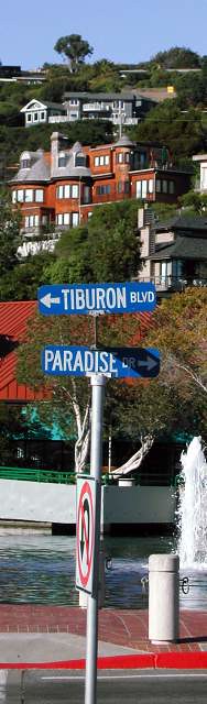
Tiburon is served by two bus lines, the commuter Route 8 and local Route 19, the Blue & Gold Ferry, and paratransit. Route 8 goes from Belvedere to San Francisco via 101 and carries about 57 passengers per weekday on its very few runs south. Other than school runs to Redwood High, Route 19 runs from Belvedere to Marin City via Strawberry and carries about 345 passengers per weekday and about 280 passengers per weekend.

Blue & Gold Ferry operates between Tiburon and San Francisco, a run that takes about 25 minutes. Though about double the price of Route 8, it takes half as long to reach the City which suits its well-heeled travelers fine.  Unfortunately, the ferry doesn't accept Clipper Cards and doesn't have timed transfers with buses in the middle of the day.

To address the problems of low ridership, MT has developed a whopping 15 proposed service changes ranging from a shorter, more frequent line to improving bicycle access. You can see all the proposals here.

There are three types of alternatives: the first deals with bus route length and frequency, the second with paratransit like dial-a-ride and taxis, and the third with non-bus transportation.  When presented with such a plethora of options, it's good to keep in mind some core transit rules (most of which I unabashedly take from Jarrett Walker):

  1. Well-spaced high-frequency corridors that intersect in a grid and anchored at walkable destinations.
  2. Easy connections between transit modes and lines.
  3. People tend to stick with transit once they're used to it.
  4. Pedestrian-friendly areas around stops and stations.

These fit well with some of the comments from ferry riders who were asked what would get them on the bus:

  1. Increase service frequency, especially around peak hours
  2. Closer bus stops
  3. Faster travel time (mutually exclusive with closer stops)

As of press time, the online survey wasn't closed, so we don't know for certain what their preferences are. However, Robert Betts, the Marin Transit planner charged with the changes, said preliminary feedback at workshops showed a strong desire for better service frequency, connectivity to schools, and improving Blue & Gold Ferry's role in the peninsula's transit network.

Let's see how the alternatives stack up against the recommendations.

Fixed Route: Alternatives 1a-1e and 3a-3b

Of the fixed route plans, none meet all the recommendations, though 1a comes closest. With 30 minute headways all day, the shuttle service (I hope they call it something that doesn't connote the wretchedness of getting around an airport) between downtown Tiburon and Strawberry should be the backbone of Tiburon service. I'm not so enthusiastic about 1b (downtown to Marin City via Mill Valley) or 1c (downtown to Manzanita Park & Ride) mostly because of frequency and cost. Well-timed transfers could do it better.

Adding the school route of alternative 1e to Marin Catholic High School would complete the transit picture, giving kids an alternative to car ownership and taking a helluva lot of cars and their novice drivers off the road. I'm less enthusiastic about alternative 1d, which adds two rather roundabout school routes. I'd rather see them branded as school supplementary service rather than proper bus lines, and, given what they serve, I'd rather the cost come from an agency other than Marin Transit.

Unfortunately, 1a misses the connection to Highway 101. The freeway is the north-south artery of our transportation system. While some routes connect at Strawberry, Routes 18, 24, 36, 70, 71, and 80 all bypass the shopping center for the Tiburon Wye bus pads. This wouldn't be a big deal if transfers were easy between 19 and the bus pads, but interchange's horrid cloverleaf layout means anyone who needs to transfer between southbound 101 and the 17 must walk half a mile to make the connection. Transfers to northbound 101 aren't bad at all, though the bus stops are just signs on poles in some ugly parking lots.

Such a poor connection dramatically reduces the route's effectiveness.  This is a bus network after all, and network effects are powerful.

Redesigning the interchange isn't in the scope of work, so routing has to be the solution. Alternative 1a should be modified to run buses across the overpass and turn them around just after the offramp's intersection with E. Blithedale. There's a parking lot there that would work well as a turnaround. Though the extra routing would add two to three minutes to the total round trip, it would dramatically improve the connection to southbound 101 and therefore the bus line's usefulness.

Blue & Gold Ferry is the best way for residents to get to the city, bar none. It's classy, it's fast, it's comfortable, and it drops people off in the heart of the financial district. It's hindered by low frequency, high cost, and poor transfer to buses.

Alternative 3b addresses the frequency concerns. Tiburon is undergoing a downtown improvement project, which would address the car-oriented nature of most of its downtown, but adding more people to the tip of the peninsula would mean traffic hell further up Tiburon Boulevard. MT should push Blue & Gold to do more and cheaper runs to the City to support a more people-friendly downtown.

The other part of 3b would establish ferry links with Sausalito. While I appreciate the thought, the beauty of Blue & Gold's routing is the effective express route to the City. The point of an intermediate link to Sausalito would be strictly for tourists, hindering the livability of Tiburon and therefore it's attractiveness to tourists in the first place. If the route would function as a water taxi, I'd be concerned about profitability. Still, Blue & Gold is a for-profit company; they wouldn't initiate a loss-making run.

Alternative 3a pushes Blue & Gold to adopt the Clipper Card, partially addressing the transfer issues between the two systems. I can't see anything wrong with unifying fare media.

Demand-Response Service: Alternatives 2a-2e

No matter how Route 19 is changed, a good chunk of the Tiburon Peninsula will go without transit. The twisting, disconnected streets and cul-de-sacs make effective transit service impossible beyond Tiburon Boulevard, but there is still a need for transit in those areas. People with disabilities, the elderly, and others need to have a way to get around.

Demand-response service allows people to order transit so they don't need to walk to a bus stop. The alternatives presented range from taxi vouchers to semi-fixed route service.  In honesty, I don't know nearly enough about Demand-Response Service to assess these options in depth, but I do have some more surface-level thoughts.

Taxi vouchers (alternative 2d) may be the best way to get people out of their homes. Most of the households are the peninsula are relatively wealthy. Though sharing a ride with a number of people may be okay, I suspect taxi service would be more familiar and comfortable to elderly people from that background.

Advertising services that are already or will soon be in place makes sense no matter how you slice it, so I'm surprised alternative 2e is presented as just another option. The rest I have no meaningful way to evaluate, and none of them are part of the feedback I've heard from Marin Transit or the existing conditions report.

Non-Transit Solutions: Alternatives 3c-3e

These alternatives present options that don't involve Marin Transit actually putting vehicles on the road or vouchers in peoples' hands, and they're all good.

Once tourists get to Tiburon, a bike would be the best way for them to get around. Alternative 3d proposes a bike share system, which would presumably be part of the San Francisco/BAAQMD system opening this fall. Such a system would be used by residents that don't want to drive up Tiburon Boulevard and by daytrippers from San Francisco and the Peninsula, where the BAAQMD system will be implemented first. What it should not be is a single station in downtown. If sprinkled up the peninsula along Linear Park they could be used for regular trips. Adding a single station would be useless to residents.

Tourists like long, leisurely rides that don't fit with the strictly utilitarian role of a bike share system. Bike rental kiosks (alternative 3c) would make more sense for them. Visitors could get up the peninsula to see the views across Richardson Bay or head to Tiburon Uplands.

For either type of bike system, it would reduce bicycle crowding on ferries and improve circulation around town for drivers (who wouldn't have to deal with more cars on the road), residents, and visitors. We'll have to wait for TAM's report on bike share this fall, but there's no reason Tiburon or MT couldn't start marketing the town to bike rental shops.

Build a Better Route

The alternatives presented will only go so far in promoting transit use. The urban environment along the route is extremely unfriendly to bus travel. Sidewalks, crosswalks, and bus shelters along the route appear only every so often, rendering the pedestrian - as all bus riders are at some point - feeling like an interloper in a car-dominated landscape.

Improving the rider experience, no matter which mode, will make the bus feel less like a second-class form of transportation. At its least expensive, Tiburon should improve connections to frontage streets and paths where they're lacking. Often the only safe way to bike or walk is on the frontage road, so it's important they be connected to the stops.

Bus shelters, though more expensive than straight pavement, are important to keeping riders out of the elements. Tiburon Boulevard isn't the most meteorologically friendly location for waiting at a bus stop, after all, and the combination of rain and the Richardson Bay winds can make umbrellas useless.

Crosswalks and sidewalks are more heavy-duty interventions but would give people better access to bus stops that may not be immediately in front of their street. If it did undertake the improvements, Tiburon would also improve access to Tiburon Linear Park and other services on the south side of Tiburon Boulevard.

The improvements to Route 19 are commendable, and integrating Blue & Gold Ferry into the public transit network will do wonders for the town. If Marin Transit pursues a short but (relatively) high-frequency bus line and creates a strong connection with 101 corridor, they'll give Tiburon, its residents and workers, the kind of transit they want and deserve.

Expect another few public outreach sessions before the draft report is presented to the MT board at the end of the summer. Whatever the recommendations, implementation likely won't start until the end of the year. In the mean time, take the survey, read the reports, and show up to those public meetings. You can sign up for a newsletter at the bottom of the reports page.

How Fantastical Is the Fantasy?

Copyright Brian Stokle The fantasy transit map of the Bay Area I brought up on Wednesday had me thinking a fair amount about Marin's transit options.  Though we are typically the odd county out when it comes to fantasy transit improvements – though Napa certainly gets the short end of this particular map’s stick – Brian Stokle’s map adds two thoughtful improvements to the county’s transit system, and I think we’d do well to explore them, as well as a third.

I should mention that I appreciate the value of bus-only lanes to a degree, but in suburban settings it is sometimes better to mix them with three-person carpools as well.  In Northern Virginia, the casual carpool system functions as another transit system, vastly improving the efficiency of private cars and, therefore, the existing car-based infrastructure.  Mixing buses and cars isn’t always the best idea, but I think for Marin it makes perfect sense, both for political and practical reasons.

The 29R Rapid Bus

The 29R rapid bus line runs in a kind of loop between Fairfax, San Anselmo, Greenbrae, Larkspur Landing, the Canal, downtown San Rafael, Miracle Mile and finally back to the Hub, where I assume it would turn around.

Rapid bus isn’t the bus rapid transit (BRT) system that we’re used to hearing about – it doesn’t have its own lanes or stations.  Rather, the rapid bus concept functions as an express, limited stop bus with some structural changes beneath the surface, mostly to how the bus handles intersections.  These, along with high frequency (every 15 minutes, maximum), makes the bus a viable alternative against the car.  Even without the frequency improvements, adding speed to a bus line makes it less expensive to run and more attractive to potential riders.

The 29R route makes sense.  The Fairfax-San Rafael corridor is the county’s densest, and the narrow valley makes it well suited to a rapid bus line.  The Greenbrae stretch, though not nearly as dense, is an important transportation corridor, and building a rapid bus line here would serve populations that are otherwise left behind by SMART.  Greenbrae is also the kind of suburban strip that is easily converted to higher, more urbanist uses.

The drawback to a rapid bus line that it doesn’t have its own corridor.  Sir Francis Drake gets backed up during the morning rush between Fairfax and the Hub, as well as though Ross and near the Greenbrae Interchange, and a rapid bus shouldn’t be allowed to get stuck in that mire.  The same goes for Second Street in San Rafael.

To compensate, the 29R should be complemented with limited dedicated lanes.  Center, the old rail right-of-way between San Anselmo and Fairfax, might be re-purposed as a rush-hour bus and carpool lane.  It’s odd to imagine a surface street being carpool and bus only, but it would take a great deal of pressure off Sir Francis Drake and speed service along the corridor.  Yolanda and Landsdale Stations, the old light-rail stops, could be reactivated as bus stops.

Though we can’t do much about the Sir Francis Drake through Ross, the boulevard widens enough at College of Marin for dedicated lanes, though an initial segment of lanes should be built from El Portal Drive to the interchange.

The Canal’s traffic patterns are less familiar to me, but it is imperative the bus not travel the narrow streets in the neighborhood, sticking instead to the much wider and straighter roads closer to the freeway.  It’s close enough to the Canal that it will be accessible, but it will keep the bus moving fast enough to justify its “rapid” moniker.

The ultimate cost would likely be in the tens of millions, and building such a system will require more forward-thinking on development issues, but the ultimate reward would be much improved Central Marin circulation.

The 80R Bus Rapid Transit

Much more ambitious is the 80R Bus Rapid Transit (BRT) line, running from Santa Rosa to the Transbay Terminal.  Presumably, the line would have limited stop service on its own dedicated lanes for the whole trip, and would share the BRT lanes with other buses running along the corridor.  It would duplicate SMART’s service between Santa Rosa and Larkspur Landing, so I wouldn’t recommend building the line north of San Rafael.

A small portion of this line is already being built by SFMTA on Van Ness, which is getting its own dedicated lanes.  Presumably other streets will be similarly improved, but that’s just for San Francisco.  The Marin and Sonoma stretch will be extraordinarily expensive, involving rebuilt or widened freeway overpasses at minimum and possibly even new tunneling in the Marin Headlands.

The first portion of a BRT system is its dedicated lanes.  Ideally, these lanes will be permanently off-limits to private cars, and would certainly be off-limits to single-passenger only vehicles, and they would stretch along the entire length of the line.  This includes the stretch of freeway south of Marin City, which could mean some extremely expensive tunneling projects or a narrower freeway.  The Golden Gate Bridge itself would need dedicated bus lanes, which in theory would double the capacity of the bridge but would be politically challenging to build.

The other portion of a BRT system is its stops.  Like a train system, the stops would be located along the right-of-way; for the 80R, that would mean building new ramps directly between its lanes and freeway overpasses, where the BRT stations would be constructed.  Alternatively, passengers might board the bus at the freeway level in an enclosed station, and access would be provided from the street level.  These would be expensive as well, and the 80R would likely rival SMART in its costs.

Once finished, though, the system would be a transit lifeline for San Franciscans working north and North Bay residents working south.  As it stands,San Francisco’s Marin-bound buses leave only every hour or so in the morning, making transit commutes rather inconvenient.  BRT would need to run every 5-15 minutes to make the investment worthwhile, tying the City to the county in a way it has never been.

What’s Missing? BART

The missing piece is a strong connection from the Transit Center to the Richmond BART station and its Amtrak connections.  Though today the 40 and 42 buses don’t get a lot of ridership, building a rapid bus or BRT line with direct connections between San Rafael and Richmond would be a boon to Contra Costa County, one of the largest sources of Marin’s in-commuters.

A rapid bus line would start at the Transit Center and proceed along Francisco Boulevard, entering 580 at the bridge.  It would make a straight shot to the Richmond station and turn around, altogether taking 30-40 minutes.  A BRT line would run exclusively on the freeway, with its only stops being at Richmond, the Marin side of the bridge, and San Rafael.  Such a run would take about 20-30 minutes.

Though it would face the same challenges as the 29R and 80R, I like this route because it would provide easy transit between the Delta, the East Bay, and Marin while connecting Marinites with existing rail options the county doesn't have.  Given that the balance of commuting is East Bay to Marin, it might make more sense to build it as an AC Transit system, freeing Golden Gate Transit from making such a huge investment for residents outside its district.

In Sum

In sum, the two improvements, plus mine, are strong service improvements for Marin.  Other parts of Marin could use a rapid bus system similar to the 29R, especially the Mill Valley to Sausalito corridor.  Less plausible is a SMART service improvement, providing 30 minute headways all day, and even less would see the system double-tracked and electrified with 5-15 minute headways, which would likely require another ballot initiative.

Fantasy maps like Stokle’s aren’t meant to be entirely practical, of course – they’re meant to make us imagine what our cities can be like, and what they might be like if we ever get around to it transit improvements.  I’d like to see more of this – how about you?

Mid-Week Links: Plans from On High

Plan Bay Area

  • Pacific Sun has a wonderful rundown, as they so often do, of the issues surrounding One Bay Area and Plan Bay Area - from the workshops disrupted by tea party agitators to historical context to just what the plan actually hopes to achieve.
  • One Bay Area has cut job and housing growth projections for Marin, with significant housing cuts in some towns and dramatic increases in others.  Town planners will be consulted for the next draft figures, to be released in May. (IJ)
  • However, Supervisor Judy Arnold, Marin's alternate representative to ABAG,  called Plan Bay Area's projected job increase in Marin unrealistic, citing a shrinking, rather than growing, job pool in the county. County staff will examine the numbers, and a decision will then be made whether to proceed with an appeal. (IJ)

Marin County

  • The Downtown San Rafael BID will get a $250,000 cash infusion for advertising and events after Keep It Local San Rafael settled their lawsuit against Target and Cal-Pox. (IJ)
  • San Anselmo is still tied in knots as it tries to tighten design review ordinances.  Neighbors are still upset over the addition to Councilmember Kroot's home. (Ross Valley Reporter)
  • Joe Casalnuevo, who successfully challenged county ordinances over whether split lots needed to pay in-lieu affordable housing fees, has taken Marin to court over the fight, alleging $60,000 in damages and time lost fighting the fee. (IJ)
  • MCBC is taking volunteers for its annual Bike Locally Challenge, though at six months it may be a bit long for a promotion.  Arlington County, VA, does a month-long Car Free Diet that involves bikes and transit - perhaps Marin Transit could cross-promote? (Pacific Sun, County of Arlington)
  • Copyright law overrode local preference in Tiburon, where the council approved CVS's red sign, overturning the Design Review Board's ruling that it should be a gray and white sign. (IJ)
  • And...: Fairfax will at last install cameras for town council meetings. (IJ) ... Ross Valley School District residents will vote on a $149 parcel tax in June to help stave off a budget crisis in the district. (Patch) ... Marin Transit tweaks Novato and Terra Linda bus routes. (IJ) ... Joseph Eichler designed more than just tract homes. (Bay Citizen)

The Greater Marin

  • While the focus of California High Speed Rail has been on just about everything but its utility, Central Valley cities are clamoring for the infrastructure. (LA Times, Fresno Bee)
  • Midcoast San Mateo is struggling with Plan Bay Area, which is including a county-designated Priority Development Area in the rural region.  Regional officials insist the rural development area is about improving infrastructure, not housing development. (San Mateo County Times)
  • Transit signage in the Bay Area are poor, and that's actually no surprise at all.  Though MTC is on it, it's unlikely Marin will see much of the fruit of their labor given our county's current transit state of affairs. (Transportation Nation)
  • More people took public transit in 2011 than in 2010, the most since 1957, and that bodes well for the future of transportation and our cities. (New York Times)

Mid-Week Links: Not Quite Paradise

TiburonMarin

  • Traffic along Tiburon's main road is getting worse, but its bus line is one of the least-used routes in the Marin Transit system.  TAM, MT, and the town think improving school-time bus service may do the same trick it did in Fairfax, although they're exploring other options as well. (IJ)
  • The historic building that housed Amazing Grace Music, the old instrument shop in the Redhill Avenue median, is gone. The San Anselmo landmark business has moved up the street thanks to George Lucas, who funded the project and lives a block away. (IJ)
  • Fairfax has its gateway supermarket back, now that the Good Earth has opened on the east edge of town. The corner has undergone a major transformation over the past few years, and the store looks set to become even more of an anchor for the town. Not to say that everyone's happy - a local merchant dialed 911 to complain about a lack of parking. (Patch)
  • Neighbors were up in arms over CVS's plans for a lit sign in Tiburon, but it turns out businesses are already flaunting local regulations. (IJ, Mill Valley Herald)
  • MALT's housing-oriented cousin, CLAM, has a new director with an eye towards smart growth and the particular human/nature balance that marks West Marin's villages. (IJ)
  • The Marin Board of Supervisors were busy this week dissolving the county redevelopment agency, reallocating funds for road repair, rescinding the priority development zone for homes around San Quentin, and bolstering their rainy day fund. (Patch, IJ)

Bay Area

  • The Metropolitan Transportation Commission wants high school interns this summer, and is actually willing to pay them. I'd be all over this were I 18 again. (Patch)
  • Parking in San Francisco could get even more expensive if SFMTA extends parking hours to Saturday evenings and Sundays.  That GGT ride just keeps looking more and more attractive. (SFist)
  • SMART's rolling stock is on track for a 2013 delivery, and it turns out they're not the only customer.  Toronto will purchase the same vehicles from manufacturer Nippon-Sharryo, and SMART, as a partial designer of the heavy DMUs, is getting a cut of the profits. (Press Democrat)
  • Rohnert Park's SMART station has officially been relocated to the city's center, much to the joy of all parties. Rohnert Park plans on building a downtown based around the station. (NBBJ, Press Democrat)

The Greater Marin

  • Raleigh, NC, is pushing the envelope when it comes to getting people to walk. But it's not the city doing the push - it's people who care enough about Raleigh to do what needs to be done, and sometimes that's just signage. (BBC)
  • Google has been instrumental in bringing transit data into the digital age with its GTFS protocol, allowing people to plan trips using transit instead of just cars.  Golden Gate Transit and Marin Transit are not currently participants, but are actively working on getting online. (Xconomy)
  • Nashville has gone for the gold and released a new downtown zoning code that essentially does away with much of the zoning.  No more parking minimums, no more prescribed uses, no more setback requirements. (Old Urbanist)
  • Norfolk, VA's The Tide light rail is going like gangbusters, beating ridership expectations in only six months. It faced much the same criticism as SMART, although the two systems will be rather different, and only time will tell how our rail system pans out. (Virginian-Pilot)
  • Building good bike infrastructure means more than painting sharrows, as Marin loves to do, and sometimes it means giving bicyclists their own traffic signal. (SanFranciscoize)

Bringing the Spider Map Home

The greatest problem with bus lines is that nobody knows where they go.  While light rail or streetcar tracks are not for every route, they do let people visually understand where transit goes.  Buses, however, travel along the same roadways as cars, leaving drivers in the dark as to where they go.  Communicating a route properly is extremely important to pulling back the veil of our transit system, and for showing people how transit is freedom from the car.

To address this problem in at least one corner of Marin, I've designed a draft spider map for the San Anselmo Hub (PDF).  We discussed spider maps previously; in short they are schematics of where buses intersecting a certain point run.  Such diagrams are used most successfully in London where they integrate with Tube stations, although DC has made some forays into this field of late by putting bus line schematics at bus stops and huge Transit Information Displays, or TIDs, in their metro stations.  (If anyone can find me a PDF of those TIDs, I'll be forever grateful.)  The point is to simplify a bus map by pulling out any unnecessary clutter and isolating just the bus routes, showing where riders can go without transferring.  It is, at least to some degree, a map of the freedom available to you from a given point.

My Hub spider map don't show all the stops, as those can change.  Rather, the map shows primary stops that are unlikely to change, such as Marin General Hospital.  The route lines and stop circles are displayed differently depending on levels of service to give riders a clear visual of where they can always go and where they may need to check a schedule.

As people generally don't care what service they use to go from point A to B, I included all possible transfers along with easily-identifiable logos at all stops where applicable.  This is best seen at the San Rafael Transit Center, which has transfers to all over the North Bay. Transfers in San Francisco, such as connections to the Cable Car, may be valuable to families that want to spend a weekday as tourists in the City.  Including such data also helps riders start to build a mental map of transit beyond Marin, adding connection points to knit them all together.  Plus, it provides advertising for the other agencies.  I had  never bothered to take the bus to the Oakland Airport, but now I know I can.  If I want to take a bus to the City of Sonoma, I know I can take the 38S, even if I don't know when.  The regional transit network map is intended to be an aid in that process.

Giving people a destination-based frequency guide shows riders how they could go from A to B.  If I'm in San Anselmo and I want to get to San Rafael, I don't care if it's I take the 23 or the 22.  The two lines complement one another along that corridor, and the frequency table reflects that.  Given space restrictions I did not include a full-fledged timetable, but I'm assuming other signage is nearby.  Timetables will still be necessary, as this map is for outbound trips only; the 22 doesn't always leave from Sausalito and once per weekday winds through Mill Valley on its way north, but never does going south.  These inbound trips are not visualized, and could confuse travelers.

The rest of the design is taken from MTC's TIDs (PDF), which are sadly missing in Marin.  The orange i logo, the headers, the green were added to visually identify this map with those more common maps.  A San Franciscan visiting San Anselmo would instantly recognize the visual vocabulary, knitting together in their mind that the Hub is still part of the regional transit network even if MUNI doesn't run buses there, and a San Anselmoan would feel a similar sense of recognition when leaving the county.

I chose to map the Hub mostly because I know San Anselmo best, but also because of the location's flexibility.  With some modifications it could be adapted for use up and down Ross Valley.  Used in conjunction with broader system maps and timetables, it would be a powerful tool for Marinites.

Since it's a draft, I'd appreciate any comments and criticisms.  You should know that I added a small border around the map, which is why things look a bit more squished inward than they otherwise ought.  If you think it's good enough as it is, feel free to print (and laminate!) a copy and put it at the Hub.  If you do, send me a picture: thegreatermarin [at] gmail.com.  I designed it on tabloid-sized paper, less than half the size of a traditional TID, so you can print it out without much hassle.

What do you think?  What TIDs and maps should come standard at any Marin transit hub?

The SMART Area, Part 4: Buses, and the Future

Golden Gate Transit

Over the last few days I've been posting my impressions and comments regarding the San Rafael SMART Station Area Plan. It’s such a large, complicated, and potentially game-changing document that it needed more than just a single post. So far, we’ve covered land use and parking, and mobility, and this last post will cover buses the future of the site.

The hero of mobility in the Station Area Plan will not be SMART; it will be Golden Gate Transit. If a Sonoman wants to get to San Anselmo, she will likely go by bus. If a new resident in the Area Plan wants to go to San Francisco, he will go by bus. And if a Corte Maderan needs to get to Santa Rosa, she'll probably take a bus first. Yet, the bus system, as it stands, is widely lamented as inadequate, especially on weekends. How to improve long-range (beyond 2 miles) mobility for residents in and through the area, and how to accommodate the increased service in the study area, should certainly be part of the conversation.

The typical Marin bus route runs every 30 to 60 minutes and is far slower than driving an equivalent distance thanks to a few crazy loops, some too-compact stop densities, lack of signal priority, long stop layovers, and the general restrictions of running on surface streets in traffic. Although there is an effective and complicated transfer system, thanks to a 95% on-time rate, the bus as it currently stands is not a car-replacing transit system.

This bodes ill for transit-oriented development in the Plan Area, not to mention other towns that want to orient their ABAG zoning towards transit – essentially the whole of Marin except for Novato. Without an adequate framework, increased population will lead to more sprawl, meaning more traffic, more pollution, and less open space. We must make the bus work.

There's a debate in the activist community regarding how exactly to do that, but it comes down to a few priorities: improve the absolute quality of the bus service through frequency, improve the relative quality of the bus service by making cars a less attractive choice, and improve the efficiency of rider collection by putting residents and jobs near the stations. In the ideal this means bus rapid transit or just separated lanes, but in Marin's medium-term, such BRT lines on the old rail rights-of-way are probably politically infeasible, and auto mode share would likely remain too great to support the service. Express buses, however, make perfect sense.

Whenever I ride GGT, I hardly see any on-and-off boarding between major stations; people are going from center to center, and ridership is not evenly distributed along the route. GGT should acknowledge this and operate a high-frequency town-to-town express network. GGT's last semi-comprehensive system analysis showed that such express service, combined with developing a system of “green hub” transfer points, would benefit a huge number of riders. If marketed with SMART – a rubber-tire rail – GGT could have a success and draw riders out of the new developments along the SMART corridor.

To boost ridership more generally, GGT should mail every adult within a half-mile radius of the Transit Center a pre-loaded Clipper card with a year-long GGT unlimited ride pass, perhaps in conjunction with the proposed Zipcar membership. San Rafael should allow local businesses to cash-out of some parking requirements by purchasing annual transit passes for their employees. Boulder did something similar to these proposals and saw drive-alone rates drop from 56% to 36%, with the bus taking up the slack. Give people something of value, and they will respond.

The Area Plan makes no mention of improving overall bus capacity or promoting ridership, but it does make some recommendations on how to move the Bettini Transit Center to the SMART site. None of the proposals struck me as particularly attractive, as most of them involve transforming the blocks around the SMART station into rather pedestrian-unfriendly surface stations akin to the Bettini Transit Center today. Other proposals, such as putting bus bays along Heatherton and under the freeway are more attractive from a pedestrian perspective but offer limited capacity.

If San Rafael decides it needs a new parking garage west of 101, the bus terminal should be located to the ground level, giving riders a more weatherproofed facility and allowing the height above the terminal to be used effectively. Bettini's lack of developability is one of the major arguments in the Area Plan for its demolition, so the city should try to lump its desired but ugly infrastructure together. Using the example diagrams from the Area Plan, such a garage would likely provide between 10 and 20 bus bays, depending on the configuration and location of the garage.

The Future

SMART is coming to town, whether people want it or not, and with it will hopefully be a new neighborhood and a new swagger for San Rafael. The city has a chance to come to the forefront of urban policy in the North Bay through innovative (for Marin) land use practices like form-based zoning, parking minimum reform, and true transit-oriented development. Until now, these have simply been words in general plans and housing elements, but San Rafael may actually make it happen. The opportunities here should excite everyone who supports a more walkable, livable, and sustainable Marin.

That's not to say there aren't challenges. Parts of the city staff have a history of choosing car capacity over pedestrian-friendliness, and powerful organizations such as the San Rafael Neighborhood Association could still throw their weight against passage. Both impulses should be resisted by the Council. The opportunities are too great to let this plan slip by.

The Citizens Advisory Committee is meeting on February 2 at 7pm in San Rafael's Community Development Conference Room. The draft plan will go before the City Council some time in March. The Greater Marin will likely be back to its regularly scheduled programming Wednesday.

Maximizing Golden Gate Transit: Wayfinding from A to B

Marin isn’t known as a transit-oriented place, despite its deep green ideology.  While fewer than 45% of San Franciscans drive alone to work, a full 74% of Marinites do.  In other places, low transit ridership is due in part to the opaque nature of bus routes and schedules, and GGT is certainly opaque.  What might it do to become more transparent?

The first problem is one of bus routes.  Many riders, if they don’t know a bus route, don’t know where they’ll end up if they board the bus.  Unlike a rail-based system, riders can’t look at the rails and see where they go.  Only specialized knowledge, gleaned from studying the bus map or utilizing wayfinding tools like 511.org, would allow an inexperienced user to utilize the bus system by feel.

Transit centers present a special difficulty because of the plethora of options.  If I want to go from Sausalito to the Seminary Drive bus pad, I first need to check to see what bus numbers depart from Sausalito, then what routes look like they might serve Seminary Drive.  The 70 and 80 have asterisks next to them so I don’t know if they’ll come by Sausalito.  The 10 might, too, but it also has an asterisk that says it might not serve Seminary.  The 22 probably does, but getting back I might need to get on someplace else because it looks as though it veers off someplace near… Forget it, I’m taking the cab.

This should not be so hard!  I look at maps like this every day in a much more complicated bus network and this confused me.  Any route that hits Seminary Drive from Sausalito doesn’t even always make it to Sausalito or Seminary Drive.  I only know this because of side notes that say, “Check timetables.”  On top of that, there isn’t an easy way to say that every X minutes a bus departs Sausalito for Seminary Drive.

What if I don’t want to go to Seminary Drive but want to see where I can go from Sausalito?  I’d know the end points but not the stops in between without studying the map to find the small numbers and make sure the tiny color lines match up with the numbers’ coloring.  Knowing where to go has turned from easy to highly technical, and this is only a small transit center; San Rafael would be significantly worse.

Without dramatically altering the routes to be more consistent, good graphic design can help lower the barriers to bus usage significantly.  One of the best ways to address wayfinding is what is known as a “spider map”, a concept widely used in London’s bus system.  It takes the jumbled mess of bus lines near a Tube station and charts them out to their ends, with major stops marked.

It does this in a cartogram, rather than a geographic map.  By removing the geographic data and showing only the most important stops, the map can most effectively highlight the most useful service data.  Differing line colors or patterns show visually the various exceptions to the rules, such as partial or peak-only service, and general trends of service, such as which “trunk” the line goes along or bus headway.  This grants the bus system the same clarity as a subway system and visually associates the lowly bus with the ease and comfort of rapid transit.

Making buses work for casual riders is a perennial problem.  Even here in Washington, DC, I know many people that live here months or years without ever boarding a bus.  Understanding the bus system is seen as Deep Knowledge of the system’s otherwise impenetrable black box.  Yet in Marin, the bus is our only mass transit option.  It is imperfect, but it is comprehensive, and converting a driver to the bus will require it to be much more than the confusing map of seemingly random lines it currently is.

This addresses casually knowing how to get someplace, but knowing when to show up for your bus is still a problem, one we’ll address next week.

Mid-Week Links: Spin Cycle

[vimeo http://www.vimeo.com/29401217 w=620&h=349] Marin has one of the best recreational cycling cultures in the country and a burgeoning commuter cycling culture, but everyday travel is typically done by car - you can blame our beautiful and formidable geography for that. Cycling For Everyone from Dutch Cycling Embassy gives a vision of how Marin could look if we embraced the bike in Terra Linda as much as we do on Mount Tam.  The Pacific Sun has an excellent rundown on the political debate so far, from the Capitol to the Alto Tunnel.

The Greater Marin

It's so easy to focus on Marin and its foibles that sometimes we forget that other places are doing awesome things.  Take Norfolk, VA, an active but small city of 242,000 people and one light rail that goes by the name of The Tide.  The Tide is brand-spanking new and underwent the same issues SMART is dealing with today: cost overruns, plans cut short, and political opposition.  After surviving that gauntlet, The Tide opened to great fanfare this past August.  One month in, the Richmond Times-Dispatch examined how the city feels about it now.  In a word, they're proud.

Marin County

  • Of course, if RepealSMART gets its way, SMART will just be a failed dream.  The anti-rail organization started gathering signatures for its repeal measure this week.
  • In good news, MTC approved its $33.1 million SMART bailout (PDF) and recommended to the Federal Department of Transportation that it receive another $18 million (PDF) in federal funding for the accompanying bike/pedestrian path.
  • The IJ has profiles on Town Council candidates for Corte Madera and San Anselmo, and Patch will host a candidate debate for San Anselmo on October 5.
  • Tensions in Sausalito came to light when Councilmember Carolyn Ford filed battery charges against Vice-Mayor Mike Kelly for hitting her hand (rather hard) during a council meeting.  Video at the link.  Kelly has since apologized, but no word on whether the charges will be dropped.
  • The empty seat left by Joan Lundstrom's retirement from the Larkspur City Council must be filled, either by a special election after the current election is over or by an appointment.
  • Speaking of Larkspur, Piper Park is due for a makeover.
  • San Rafael's Design Review Board approved the Fenix Live music venue for the heart of Fourth Street.  You can hear the Board's deliberations here.
  • Novato wants to sprawl, and, as much as it hates density, it loves its sprawl.  Planners just approved a 3-unit-per-acre subdivision.  Larkspur isn't much better after the sale of a pre-approved 5-unit-per-acre development. That one is just one block from downtown in a prime walkable development location.  You can check out a possible site plan for Larkspur here (PDF, p. 13), although it may not be accurate because of the change in ownership.
  • Ever wondered what the deal is with that empty commercial building at 520 Red Hill Avenue?  Now you can find out.

The Golden Gate

Golden Gate issues deserve their own section this week because the sheer number of news items cries for special attention.  It cries, we answer.

  • Golden Gate Transit will install WiFi on all its buses, making it an even more attractive transit service.  Cost is cheap, too: only $610,000 for the final cost.  Take that, BART.
  • Marin Transit wants to reopen their $15 million/year contract with Golden Gate Transit to provide local bus service in Marin.  Marin Transit argues that GGT is overcharging by about 23%, while GGT argues the extra cost is due to regularly scheduled overtime.  Sounds like GGT has a staffing problem.
  • The Golden Gate National Recreation Area will be reconfigured under a preliminary general management plan with the aim of "connecting people with parks."

Housing in Marin Part 1: Transit

Not exactly consistent While Novato is in the throes of a major debate on affordable housing brought on by the Association of Bay Area

Governments’ mandates, it is important to take a 30,000-foot look at Marin County’s urban character, which contributes so much to the appeal – and cost – of the county.  An excellent case is the Fairfax-San Rafael corridor.

Most of the cities in Marin advocate for improved density around transit centers.  There is a problem with this, however: the transit sucks.  In the Fairfax-San Rafael corridor, the lynchpin is San Anselmo’s Hub.  The Hub is served by six bus routes going east, west, and south, and about a third of town is within a half-mile radius.

San Anselmo-San Rafael

The basis of effective TOD is simple and easy to understand transit routes.  It should not be necessary for riders to memorize multiple schedules in order to use the system.  One of the great things about a car is that it gives the rider the capability to leave when they want; one isn’t beholden to a timetable, as one might be with a bus or train.

Increased frequency is one solution to the problem, as anyone who has ridden on New York’s subway can attest.  Show up, wait five minutes, and catch the train as it comes by.  If you missed it, there’s another one not so far behind.  Buses can function like this, too, with headways on certain MUNI routes approaching that of a subway.  In suburban environments, where such frequencies are uneconomical, creating a reliably consistent schedule is a good second-best option.

Unfortunately, the existing bus system from the Hub doesn’t cut it.  Headways alternate between 15 and 45 minutes for most of the day, forcing passengers to know not just one bus schedule but three, with each changing throughout the day.  This is no way to run a bus system.

There is, however, a better way.

Much better

In my scenario, I've averaged the headways to a maximum of 30 minutes all day.  Even with the variations from afternoon rush hour, a rider always knows that a bus will come in 30 minutes at most.  To create this scheme, I shifted the entire 23 schedule back by 15 minutes as well as a selection of the 22 departures.  Departures from the Fairfax Parkade to the Hub also become more regular, with headways declining from a maximum of 48 minutes to 35 minutes.

Similar patterns emerge for southbound routes.  Buses bound to the College of Marin – the last common stop between routes 22, 24, and 29 – have headways that vary between 20 and 40 minutes.  Although the 29 is well-timed with the ferry, such variations are unacceptable for travel within the corridor.

Balancing bus schedules is not easy: what’s been proposed here is only one option for one corridor.  Tackling this problem, however, is well worth the effort.  The constant push from the Association of Bay Area Governments for more housing under the “fair share” doctrine means that every town must look at places to build.  If Fairfax and San Anselmo want this housing to be a benefit rather than a sprawl-making burden, developing reliable and effective links to the rest of the County is imperative.  The cheapest way to start is through making the most of the transit we already have.