Grady Ranch Is All Wrong

A great place for some infill development. Photo by Skywalker Properties. George Lucas’s great foray into affordable housing is wrong for Marin, wrong for affordable housing, and wrong for the people that would live there. The Grady Ranch development plan needs to be scrapped.

After the collapse of LucasFilm’s Grady Ranch studio proposal, then-owner George Lucas promised to build affordable housing on the site instead. Many observers, including me, saw it as payback to the Lucas Valley anti-development crowd that killed the studio project, but few thought George was serious.

Yet Lucas and his partners at the Marin Community Foundation are charging ahead with 200-300 units of affordable housing anyway. While it does present an opportunity to build affordable homes, the site couldn’t be worse.

Grady Ranch is located out on Lucas Valley Road, far from any downtown, commercial center, or regular transit line. It’s right at the edge of the North San Rafael sprawl line – a car-oriented area even where it’s already built up.

Lucas Valley Road itself is essentially a limited-access rural highway, with cars speeding along at 50 miles per hour. There’s no development on the south side, and the north side only has entrances to the neighborhoods. No buildings actually front the road. Yet, it’s the only access to the Highway 101 transit trunk line, to nearly any commercial or shopping areas, or between neighborhoods.

Development here would be bad by any measure. Car-centric sprawl fills our roads with more traffic, generates more demand for parking, and forces residents to play Russian roulette every time they want to get milk. It takes retail activity away from our town centers, weakening the unique Marin character embodied in downtowns.

The infrastructure, too, is inefficient. Grady Ranch would need to be covered by police service, fire service, sewage, water, electricity, and some modicum of transit, but those costs are based on geography, not population. Serving a square mile with 300 homes is a lot more expensive per home than a square mile with 1,000.

Yet the fact that this will be affordable housing makes the project even more egregious. Driving is expensive, with depreciation, gas, maintenance, insurance, and parking costs all eating up scads of money. On a population level, you can add in the cost of pollution, as well as injuries and deaths in crashes. A home in Grady Ranch would be affordable, but the cost of actually living there would be quite high.

The nonprofit aspect of the project would mean no taxes could be raised to cover its infrastructure and services. Building affordable housing in a mixed area means they’re covered by preexisting services. Though usage is more intense, there is typically enough spare capacity to take on more residents. Building something beyond current development means new infrastructure and services need to be built specifically for that project but without any existing residents to pay for it. It would be a massive and ongoing drain on county coffers.

This is the worst possible place for affordable housing. Grady Ranch, if it’s not going to be a film studio, needs to remain as open space. An affordable housing project out at the exurban edge of Marin cannot be affordable because car-centric development is fundamentally unaffordable.

I respect the efforts of George Lucas and Marin Community Foundation to find a place for the low-income to live, but Grady Ranch is not it. Lucas and MCF need to look at urban infill sites and focus on building up in those areas that are transit-accessible and walkable, places that are actually affordable. Replicating the discredited drive-‘til-you-qualify dynamic in Marin is not the answer; it’s just recreating the problem.

Don't Walk in Sonoma County

Crash Sonoma County, as you may have noticed from my weekly Toll segment, has a significantly higher tempo of death and injury from cars than does Marin. Though road design is a large part of the problem, another might be unjust enforcement of the law.

Last month, Jared Whisman-Pryor severely injured a bicyclist and fled from the scene on his motorcycle, only to be identified later in surveillance tapes. Unfortunately, Rohnert Park police aren't even trying to arrest him, saying the bicyclist may have been at fault. So rather than try to prosecute Whisman-Pryor for a hit-and-run that left a bicyclist unable to walk, they're looking for a way to lay the blame on the bicyclist. They don't want to arrest Whisman-Pryor; they just want his side of the story.

Meanwhile, Santa Rosa police have determined that the death of Joseph Von Merta, 44, and the injury of Robert McKee were their own faults because they were drunk when crossing the street. McKee, the victim of a hit-and-run drunk driver, was in a crosswalk at the time of the crash. Pedestrians in the roadway have the right-of-way, so how he could be at fault simply for being drunk, especially when in the crosswalk, is beyond me.

The police's finding that Von Merta's death was his own fault is more understandable.  He was crossing against the light, and so should have yielded to the right-of-way of vehicles, but his level of intoxication at the time should not come into play. Indeed, in this instance, it is still the responsibility of roadway designers to ensure the natural speed limit is a safe one. Von Merta didn't need to die that night.

In the cases of Jared Whisman-Pryor and Robert McKee, it's unconscionable that we don't hold drivers accountable for their own actions, especially when so often they result in injury and death. Santa Rosa and Rohnert Park need to get their acts together.

Marin Should Invest in Marin

A couple of guys out in DC are making waves in the real estate investment world, and I think it’s worth Marin taking a look.

While The Atlantic Cities has a fuller rundown who Dan and Ben Miller are and what they’re up to, the basics of it are simple. The Millers want to enable local, individual investors to invest in shares of real-estate. Normally, the SEC makes it illegal for anyone to invest in someone else’s property:

You can invest in buying your own home. But you can’t buy into a true real estate deal unless government regulators believe you're wealthy enough to know how to handle your own money. Until now, the Millers themselves have been restricted to raising funds from accredited investors they personally know. This is how the system works: If you want in, you must know the right people and have enough money – six or seven figures' worth.

This stifles investment in small properties because the folks with the money typically also don’t want to invest in small projects with low margins, or in the eclectic business plans that make retail corridors so diverse and interesting.

Long story short, they figured out how to do it legally, through the SEC’s little-used Regulation A, and they want to expand the idea.

Now, the Millers’ pilot project was renovating a store on a half-blighted retail corridor in the District, but the concept, which they’ve packaged under the company Fundrise, is transferable to anywhere in the US, and that’s where Marin comes in.

To for-profit developers, Marin poses a bit of a problem. The development environment –very short height limits, restive neighbors – makes it unprofitable to invest in most small projects. Yet nonprofit developers pose a problem for county and local budgets, immune as they are from parcel and property taxes.

Yet Marin has fantastic wealth and a highly involved, business savvy people. Entrepreneurs should be able to tap into this talent pool to fund projects that really aren’t outside developers. Perhaps those restive neighbors who drive out developers could end up funding their own developments.

There’s no shortage of vacant lots or sub-par uses. San Anselmo has that rotting partially-finished building on Sir Francis Drake. San Rafael has a huge vacant lot on Lincoln and Mission. Novato has its own vacancies, as does Mill Valley. The Town of Corte Madera took up the role of investor by buying out a rapidly declining shopping center. From Dillon Beach to Sausalito, there are a huge number of opportunities. Rather than walk by and wish something else were there, you and your neighbors could actually do something about it. Why wait for George Lucas or Phil Lesh to swoop in?

If the community wants something in a location, Fundrise could offer a way for the town not just to build or renovate but to literally reinvest in the community. It’s like It’s a Wonderful Life, but with real estate securities instead of bank loans.

Well, you might say, this is a bit crazy. It’s too risky, too legally convoluted, for use outside of a few projects out in DC. But it’s not just the Millers who want to do this; it’s coming from California, too.

"There’s a real disconnect between capital flows in real estate and the communities to which money and opportunity go," [LA City Council President Eric] Garcetti says from Los Angeles. He was skeptical at first that average citizens would want to bridge that divide. The investment sounded too risky. But the culture is changing, he says, particularly among technological early adopters and Millennials who are demanding all kinds of new hands-on roles in their communities. "In neighborhoods like mine," Garcetti says, "where people are very savvy about the particular grind of the particular kind of coffee that’s in a particular café, I think they’re going to be pretty well-informed real estate investors."

A common complaint about me is that I live in DC, that I don’t ‘get’ Marin, and so have little right to comment. It's a silly argument, but it does reflect a zealous protection of Marin's quirks and special character. Who gets Marin better than Marinites? And who would know better than Marinites how invest in their own community?

In other words, Marinites, not big developers, would build the towns they want. Marin wouldn’t need big developers to swoop in and fill vacancies. All we need is an entrepreneur and a business plan the community could get behind. Ruin Marin? Hardly. It would be Marin.

The 101 Bus Pocket Guide

By popular demand, I've reworked the Highway 101 Strip Map into a printable version and added a timetable. Print this out and stick in on your wall, shove it in your (man) purse, or gloat to friends that you actually know where you're going. Because you deserve it. If you're a bus driver, defy your superiors and put this on display where passengers can see it when doing a 101 run. Seriously, they'll thank you.

Guides like this one are extremely useful for complicated, but important, pieces of transit infrastructure. How all the routes come together to form a single bus system from top to bottom is what makes 101 the trunk line that it is. Leaving it unmapped, as GGT and Marin Transit have done, simply hides from the public how much transit is actually available to use.

What to Do if You Come Across a Bike Crash - Comments

Last week I posted on Greater Greater Washington about what to do if you come across a bike crash. Though I thought it was fairly thorough, the comments provided a fantastic appendix to the piece. The purpose of my piece was to inform potential bystanders to be aware of the needs of the situation and be conscious of any roles to play. Commenter SJE wrote with a proper hierarchy:

I agree it is important to take charge, and direct people. Most people don't know what to do. Important tasks:

1. Caring for victim 2. Collecting witness statements. Best to get via smart phone, so is verbatim and can be used in court 3. Ensure driver does not leave 4. Directing traffic 5. Calling for help and police, and relatives. 6. Looking after the broken bike.Another thing is not to focus on blood. People die all the time from internal injuries, including head injuries, that show little sign of outward bleeding. If bike or car is mangled, look more closely at the cyclist.

I personally believe everyone should take basic EMS courses: you WILL use it, and it could be your life that is saved.

I didn't collect witness statements but I did have a smart phone. I didn't want to seem too intrusive, but I should have been more aware of the needs of the victim and responders. It's equally important to ensure, in a bike-on-pedestrian crash, that the bicyclist doesn't leave. A victim of a bike hit-and-run is as much a victim as someone involved in a regular hit-and-run.

Marc pointed out that talking to the victim is equally important:

1. If you are first on the scene, don't just say "someone call 911". Instead, point to someone else and say "YOU - call 911". There have been occasions where no one called 911 because everyone else thought someone else was doing it.

2. While you're waiting for EMS to arrive, one very practical thing you can do is ask for the person's medical history. Do they have any medicine allergies? Are there any major preexisting conditions the EMT's should know about? Where specifically is the pain? Can they wiggle their fingers and toes? Stuff like that.

Keep in mind that someone could be conscious right after the crash but lapse into unconsciousness by the time the EMT's arrive, so better to get the information while you can.

Ms. D wrote in about the peril of identifying as a doctor or other medical professional:

Also, ask for help in a non-identifying way. I have several friends and family in the medical field, and they've all expressed that they're afraid to identify themselves for fear their position will void good samaritan laws (which are designed to protect non-professionals who try to help and fail or end up doing harm). They DO help, but they would never say "I'm a nurse/medical assistant/etc." While I have extensive first-aid/CPR/defibrillator training due to some previous jobs (not in the medical field) and don't normally ask for help in that regard (but rather offer my help), I'd recommend asking if anyone knows first aid rather than asking if anyone is a medical professional if you don't feel up to providing the assistance necessary.

She added that having an emergency kit is handy, even if you're a pedestrian or a biker:

My emergency kit, which fits in everything but my smallest clutch, is a mini-mag, sterile gauze, a pair of latex (could also be latex-free) gloves in a sealed baggie, and some alcohol wipes. A pen and small notepad is also useful if you find yourself in charge of collecting witness information, though, as noted, smart phones have excellent features (notepad, video camera, etc.) for this purpose, as well.

Lastly, Observer gave us an update on what actually happened:

I was standing next to the woman injured in this accident Thursday night. Yes, standing. Because she wasn't on a bike. In fact, when the light turned green for pedestrians she was hit (admittedly without looking) by a bicyclist who had run the light.

Second, in response to your twitter conversation with Ron Knox, she never lost consciousness. We did have a frustratingly hard time flagging down police cars to help protect us from traffic, but EMS arrived and the woman was able to walk to the ambulance by herself.

I hadn't been taking witness statements, but the combination of bike on the curb + woman on the ground meant bicyclist struck. A few side conversations I'd had about whether the driver was still there were met with an "I don't know", so it was an assumption on my part.

What would you do if you came across a bike crash?

Midtown Manhattan crash involving bicyclist, hit by the driver of a van. As I walked home from work last night, I saw a crowd gathered at the corner of 17th and L Streets, NW. On closer inspection, a woman was lying in the road. A bicyclist had been hit. Have you thought about what you would do in such a situation?

A few people were hunched over, talking to her, trying to keep her still and calm. The rest of the crowd watched, concerned but unsure of what to do. Since I'd learned about the bystander effect, which renders people immobile rather than helpful in a crowd, I'd mentally rehearsed how to deal with a crash.

Read the rest of the post on Greater Greater Washington.

Don't Drive to the Parade

For the love of all that is good and holy, don't drive in to San Francisco today. If you've been living under a rock, or really just don't care about sports that much, here's a protip: the Giants won the World Series in a sweep, and now all of the Bay Area wants to celebrate on Market Street. In short, the roads and ferries are going to be packed. Take a bus instead.

Golden Gate Transit has a handy guide to all things Giants and transit-related. They're adding ferries out of Larkspur and Sausalito to deal with the crowds.

Easy, you say. You'll just drive to the ferry, right? Yeah, don't do that either. The ferry parking lots are already full, and the ferries themselves are full, at least for the morning. If you have time, you can swing by the ticket kiosks at either the Larkspur Landing or Sausalito ferry terminals to see if there are any tickets left for the afternoon, but in case you don't have the time, there's one unthinkable option: the bus.

Yes, that much-maligned mode of transportation has capacity to spare. As of 8am, commuter buses were emptier than normal, so they definitely have room. You can figure out how to get into the city through 511.org, Google Maps, the GGT maps, or my own guide to the freeway below. The strip map can be printed on six standard-sized sheets of paper; just choose "Poster" on your printout. Sorry, the pocket-sized version is coming out a day late.

One other thing that might prove handy is the General Timetable to 101 (PDF), which has how to get anywhere from anywhere on Highway 101.

So don't drive to the ferry, and you probably won't get a seat even if you bike or walk there. Don't drive at all. Take bus to San Francisco instead. There's room to spare.

UPDATE: It totally escaped my mind that you could take the 40/42 bus from the San Rafael Transit Center to Richmond or El Cerrito del Norte BART stations and take those into the city instead of the direct bus lines. It'll take longer, and the buses are likely delayed this morning because of heavy traffic on 580, but it is another option. Just don't drive to the stations; their lots are probably already full, too.

The Transit Benefit (sort of) Comes Back

This week, Governor Brown signed into law a $75 pre-tax transit benefit for employers to offer employees. It’s a partial fix to cuts to the federal transit benefit, which dropped from $230 to $125 this year.

I say partial because while the federal benefit applies to all companies, California restricts its new benefit to companies with 50 employees or more, excluding a hefty 40% of Bay Area workers. As well, it still doesn’t make the transit benefit equal with the parking benefit; drivers, who get a $240 parking benefit, still have an advantage.

While $230 covered any bus transit commute starting in Marin and most starting in Sonoma, $200 isn’t enough to cover Novato transit commutes to San Francisco or many Sonoma commutes. California still has a way to go to intelligently promote and fund transit, and the region continues to leave low-hanging fruit like congestion pricing on the tree, but it’s good to see the state step up where Congress has failed.

How to Make Safe Novato Streets

If last month’s tragedy taught Novato anything, it’s that residents need to take road safety as seriously as they do housing elements. Lives, not just town character or property values, can hang on things we hardly ever think about. Where should the first stop sign be when we enter Novato? What about this road makes the speed limit seem so low? There are easy ways to reform Novato’s streets to be safer for drivers, bikers, and pedestrians, but they only take us so far. Going further would require Novato to rethink the fundamental purpose of its roads. But let’s start easy.

The Gateways

The points of greatest danger are the approaches into the city, where people transition from highway to city driving. In these areas, speeds officially fall from 45+ miles per hour down to 25 or 35, though roadway design and culture tack on another 5-10 miles per hour.

To bring people from highway mode and into city mode, Novato has employed stop signs and stop lights, but these are insufficient. Coverage of the Ratliff crash included quotes from people grousing about high vehicle speeds where she was killed, yet the only indication of a falling speed limit was the speed limit sign. Everything else about the road screamed at the driver, “It’s safe to drive fast here.”

European cities use a combination of special road paint, stop signs, and roundabouts to calm traffic and get drivers into urban driving mode. Roundabouts would be a bit much for a conservative city like Novato, but paint and stop signs certainly aren’t.

Different shoulder paint tells drivers that a change is coming, while a stop sign would clearly delineate where the change actually is. The key is to get drivers out of what is essentially an automatic driving mode and into a more attentive mode. On a rural road or Highway 101, one never expects things to jump out in front of the car. The road, through paint and a stop sign, will alert drivers to this change, making them more attentive to the increased complexity of city driving.

The Arterials

Novato’s streets are themselves unsafe. At a typical driving speed of 40 miles per hour, pedestrians hit have a very low chance of survival. At the same time, the streets can have lanes as wide as those on a freeway (about 12 feet), putting drivers back into a highway mode. These arterial roads should be redesigned for safety. Above all, that means narrowing lanes to 10 feet in a process called a lane diet.

Unlike a road diet, which removes lanes to provide space for a center turn lane or a median, a lane diet just narrows the existing lanes and gives the excess space over to parking, biking or sidewalks. Novato roads already have center turn lanes, medians, and parking.  It’s hard to imagine using 28 feet (two lanes plus narrowing existing lanes) for anything useful without land accompanying land-use reforms.

But four 10-foot lanes with a center turn lane would do plenty of good for street safety. Lane diets reduce crash rates, sometimes as much as 43%. Vehicle speeds, too, are reduced by road diets and lane diets, meaning those crashes that do occur are less likely to be serious. The fact that street capacity would remain essentially unchanged is an added political bonus. Introducing lane diets to Novato arterials would make them objectively better roads.

The Bike Lanes

We still need to deal with 8 feet of extra road width on our dieted streets. Rather than using it on sidewalks, Novato should convert its class II bicycle lanes to class I cycle tracks.

Cycle tracks are fully separated bicycle paths that have buffers or barriers between them and the automobile traffic and are best suited for roads with high traffic volume or high vehicle speeds, i.e., arterial roads.

NACTO’s bicycle lane guide recommends cycle tracks widths of at least five feet with a three foot buffer. If we combine the width removed from our road lane diets with the width of existing class II bike lanes, there is enough space for a cycle track going in either direction. This improvement would increase safety for bicyclists by getting them away from car traffic without banishing them from the street entirely, increase safety for pedestrians by putting space between them and traffic, and increase bicycling by providing infrastructure appropriate to the road.

Costs are relatively minimal, at least compared to what we spend on road infrastructure. Cycle tracks typically range from about $100,000 to $165,000 per mile. For about $3.35 million, Novato could install cycle tracks on every arterial street in the city; it could do every rural arterial for about $970,000 more. Considering that we’re spending 270 times that on highway expansion, it might be worth more attention from TAM and city hall.

Such an expansive investment in bicycling in Novato would be transformative. While transit and walking aren’t terribly efficient modes of transportation through most of Novato, the bicycle is. If the city provided the infrastructure for in-city trips, it would cut down on traffic and improve the health and quality of life any resident that can ride. At least one study found that cycle tracks increase bicycling by 250% and that in turn increases safety for all road users, from driver to pedestrian, by making drivers more aware of vulnerable users and calming traffic.

Last week's post exhorted Novato to stand and say enough: enough death, enough apathy. Rather than leave it up to the process, Novatans should tell the council to fix gateways roads, shrink lanes, and invest in bicycle infrastructure that fits the needs of the road. It’s not an issue of road capacity, for it would hardly change. It’s an issue of political will on the part of Novato’s councilmembers, city staff, and residents. They have the power to make safe their city’s streets. Or they could call deaths on their streets inevitable and do nothing at all.

Is it Time for San Rafael Council Districts?

San Rafael on a Full Moon Night The recent San Rafael City Council vote on the Civic Center Station Area Plan went the way I would have liked, but given the objections of neighbors I'm surprised the vote was unanimous. Neighborhood objections such as this need a debate to ensure all voices really are heard, but the current system doesn’t serve that need. Perhaps it's time for San Rafael to consider a district-based council.

Every town council, city council, and board in Marin, barring the Board of Supervisors itself, is elected at-large. While such a system makes sense for small towns, larger cities like San Rafael have distinct neighborhoods with distinct goals, opinions, cultures and needs. Gerstle Park has concerns about noise from Albert Field, the Canal worries about street lighting, downtown is concerned about crime and historic preservation, and North San Rafael is concerned about development.

Each of these areas needs a champion for their cause, and the best way to do that is through city council districts.

Santa Rosa is considering just that. Advocates cite long-standing geographic and ethnic inequities in the seven-member council. For example, Santa Rosa is 30% Latino but has an all-white council only one Latino member. All members hail from the eastern half of the city, five from the northeast. This arrangement has persisted for at least 20 years. The Latino member, Mayor Ernesto Olivares, was only elected in 2008, and the geographic arrangement has persisted for at least 20 years.

In San Rafael, the situation is similar. Downtown and the Canal have no representation on the council. East San Rafael went 20 years before a councilmember from that area, Peacock Gap’s Andrew McCullough, was elected. I don’t know if the Canal has ever had a home-grown councilmember. In a city where close to a third of the population is minority, McCullough is the only minority councilmember, being of Filipino-American descent.

More importantly, tying members to districts brings attention and resources to those needs that may otherwise be overlooked and allows neighborhoods to hold their representatives accountable. Richard Hall, a new commenter on TGM and strong opponent of the Civic Center SAP, might viably challenge a North San Rafael councilmember if he were able to campaign in just his neighborhood. The SAP could be a wedge issue for them.

But the two North San Rafael councilmembers, Damon Connolly of Mont Marin (the neighborhood between Northgate and Marinwood) and Gary Phillips of Terra Linda, are elected at-large. In the large pond of San Rafael, Hall likely wouldn’t be able to use the SAP as a wedge issue or to use Connolly and Phillips' votes against them. Instead, the issue is likely to never get a fair shake in an election where his neighbors could actually say whether they support the plan or not.

Opponents of Santa Rosa’s district proposal argue the result will be a balkanized, divided city. Geographic rivalries would flare up and councilmembers would only look out for their own district’s needs at the expense of the city as a whole. Electing members at large, they argue, promotes consensus and comity between residents and neighborhoods.

Yet the history of divided, unruly councils is long in Marin. For years, the Fairfax Town Council was a truly contentious body but has recently returned to civility. Just this year, Sausalito’s council literally came to blows in the hand-slap heard ‘round the county.  All the while, the district-based Board of Supervisors was a picture of calm and unity. It’s not districts that divide a city council, it's rivalries and scant leadership.

Still, if San Rafael does pursue districts, it could keep its unique at-large mayoral seat, ensuring at least one member of the Council will represent the city as a whole.

As San Rafael continues to grow, the needs and cultures of its various neighborhoods will deepen and diversify. Ensuring adequate representation on the council and fair consideration of issues during elections is vital to the legitimacy of city governance and the health of city debate. It's time to consider something new.

High SMART frequency on the cheap

In response to my analysis of SMART’s potential for double-tracking, commenters Richard Mlynarik and the Drunk Engineer pointed out that other rail lines run high frequency with sidings only and not a full-fledged double track.  SMART, they reasoned, would save a bucketload of cash by building something similar, and they're right. At 15 minute headways, SMART will have at most 6 trains going in each direction once it reaches full build-out.  If they stick to precise scheduling, they will pass at 6 predetermined points. Under the current plan, SMART will run 30 minute headways under a similar scheme, with only 3 passing points of 4 miles each. At that 4-mile standard, we would need another 12 miles of track (another 3 sidings) to permit 15 minute frequency.  While my original assumption was for 56.7 miles of construction (70.5 miles minus the 1.8 mile Puerto Suello segment minus 12 miles of passing track), with this dramatically reduced need for new tracks we can shrink the cost by a similar margin. Rather than cost $284 million, 12 miles of track will only cost $60 million. That's much more reasonable.

California regulations treat sidings differently than regular two-track systems, and pegs the minimum width of the right-of-way at 50 feet, rather than 44.  While that means the sidings will interfere with the mixed-use path in the narrower segments of the right-of-way, moving the path is far cheaper than extraneous track.

Though this doesn’t give SMART operational flexibility to raise and lower frequencies or speeds at will, the currently planned system doesn’t either. Any changes in frequency or speed will require some capital investment to ensure passing tracks are where they need to be. Compared to the cost of SMART's trains, though, it's not much of an expense.

High-Speed Rail Whiplash

Given the evolving and pressing nature of the California High-Speed Rail story, Mid-Week Links will have to wait until tomorrow.

High-speed rail dominated the news and blogosphere this week, and for good reason. The California Legislature authorized - barely - releasing $8 billion in bond money so the California High-Speed Rail Authority (CHSRA) could begin construction in the Central Valley. Federal Secretary of Tranportation Ray LaHood applauded the vote, as did transportation advocates, as a step in the right direction for the state and country, though acknowledging there was still another $60 billion to find.

Project opponents pointed to a lawsuit filed the day of the vote by one-time HSR booster Quentin Kopp, who argued the current business plan, which blends high-speed trains with lower-speed commuter rail, is illegal and "mangled", but it didn't do much to dampen advocate's spirits.

The real bomb was let off the day after the vote.  The Los Angeles Times reported that French high-speed rail operator SNCF had approached CHSRA with a plan to privately finance and build the state's rail line for a fraction of the cost, though along the I-5 corridor rather than the 99 as currently planned. SNCF, the report claimed, had been declined.  Though Yonah Freemark at The Transport Politic had leaked an earlier memo from 2009 on the subject that seems to vindicate CHSRA, the Times piece dealt with a later proposal from 2010.

Steven Smith at Market Urbanism goes into more detail, quoting pro-HSR, anti-CHSRA activist David Schonbrunn that SNCF already actually had private backing in hand, and an anonymous source said the backing was from "major, major US banks", though wouldn't go into specifics. Rather than listen to the SNCF report, Smith's source and Schonbrunn claim it was dismissed out of hand. Construction firm Parsons Brinckerhoff remained at the helm of CHSRA's planning.

Smith speculates CHSRA stuck with the 99 plan for political reasons. For one thing, there are a number of employees working for both CHSRA and Parsons, and it would have been in Parsons' interest to quash the SNCF plan. Another reason is the strong political clout of the eastern Central Valley. Though SNCF had planned spur lines and urban edge stations, located like airports, backers had pushed strongly for including the Central Valley's population centers, and an I-5 alignment, while cheaper, wouldn't have achieved the desired political result.

Alon Levy of Pedestrian Observations approached from a different angle. Not much is known about the SNCF plan, but we do know the cost - $38 billion - and the alignment change - from 99 to existing rights-of-way along I-5.  The alignment change alone, he writes, cannot possibly make up the difference between today's $68 billion and the proposal's $38 billion.  Rather, most of the cost savings would have to have come from better cost control, thanks to management of the project by an experienced European firm.

Levy's takeaway, like Smith's, is political:

The other lesson we can learn from this episode is political, regarding cost escalations and strategic misrepresentation. Too many political transit supporters downplay the issue. LightRailNow claims that a cost escalation that occurs before construction starts is not a cost escalation, but just a more accurate cost estimate; Robert Cruickshank did not quite say the same when the 2010 business plan for CAHSR revealed costs had doubled, but came close to it by describing the plan as more careful and thorough. In reality, large bombshell reports shortly after money has been obligated are a hallmark of secretive, untrustworthy planning, precisely the kind likeliest to lie about costs.

It's likely the story will continue to unfold as the weeks wear on.

The story from Smith and Levy often spills onto Twitter, so if you're into that kind of thing be sure to follow them @MarketUrbanism and @alonlevy @alon_levy. You can also follow me @theGreaterMarin, though I mostly leave the HSR story to them.

Where's the Outreach?

A massive fire in Oakland blew a hole in yesterday's commute, shutting down the Transbay Tube and leaving AC Transit and East Bay ferries to pick up the slack.

It was carmaggeddon.

Now, when something goes horribly wrong in the East Bay, Marin will often get a surge of people trying to get to the City, so I expected to hear something out of our local transit agencies. Directions, guidelines, how to go from the two BART stations GGT serves to San Francisco.

Instead, I heard crickets. Absolute silence.

Located as I am in Washington, DC, I'm forced to comment on what I read rather than on what I hear. I have contacts in a few agencies (and if you ever have a tip make sure to email me at thegreatermarin [at] gmail.com), but for the most part I'm on Twitter and news sites. So when I heard that transbay was down I jumped online to see what the contingency plans were. It was around 6am for the Bay Area, so things were just starting to heat up. AC Transit had been called into service, every ferry in the various East Bay fleets were called up and Golden Gate Transit's website was overloaded.

Clearly there was demand for information and a demand for a better way to cross the Bay. People who are used to BART and AC Transit wouldn't know how to get to the City without one of those two means of transportation. I stepped in and gave some route information on how to get to SF without using the Bay Bridge, but there wasn't anything for them directly.

The point of a Twitter account, and GGBHTD has three (bridge, bus, and ferry), is to disseminate information in a timely fashion. In Washington, DC, Twitter is a vital link for riders of our subway system and our bus system. Just this past year, the local transit agency began tweeting bus delays. Since the line is manned by an actual person, the agency can answer short questions from riders, activists, and journalists easily. In smaller agencies, Twitter and other channels are used to communicate moved stops, service disruptions, severe delays, and emergency notifications, though they may not be able to afford a full-time social media staffer.

Compare this to GGT and Marin Transit. @GGBridge's last tweet was June 1, @GoldenGateBus's last tweet was May 22, @GoldenGateFerry's last tweet was June 13, and @MarinTransit's last informational tweet was July 29, 2010. This is unacceptable. Marin Transit has ongoing meetings regarding Tiburon's transit needs and has made major route changes since 2010, while Golden Gate Transit often faces delays and service disruptions as it moves people through the region.

If Marin Transit and GGT want to be taken seriously as a viable means of transportation in Marin, it needs to step up its game. When an emergency strikes, they should be ready to provide direction. When there are disruptions, meetings, or route changes, they should make an announcement through all modes of communication available. Anything less does disservice to the system and riders.

Errata of Corte Madera

While I was working on last week's post, I gathered rather more information than I needed for something focused on mall redevelopment though most of it is really really wonky.  Be forewarned.

  • While working through Corte Madera's zoning code (Title 18 of the Corte Madera Municipal Code), I found that the densest type of zoning is R-3, which allows 17.7 units per acre at most but still requires buildings occupy at most 35% of a given lot, meaning an effective floor-area ratio of about 1.  In these zones, even studio apartments need 1 parking space each, and one parking space is needed for every 10 housing units to accommodate visitors.
  • As far as I could tell, there aren't any parcels zoned for R-3 in Corte Madera. R-2 is rather more restrictive. It allows only 10.8 units per acre.
  • The minimum amount of land needed for a parking space in Corte Madera is 204 square feet. The minimum size of a studio apartment in the state of California is 160 square feet.
  • Corte Madera precisely prescribes the types of uses allowed in any given type of commercial space.  One can't, say, open a bookstore in the along Tamal Vista (zoned C-3), sell electronics parts downtown (C-1), or sharpen tools in a store at Town Center (C-2).
  • The number of units per acre in downtown San Anselmo, including the Flats, is about 15.5.  If you want to live downtown, nine stores (zoned San Anselmo's version of C-2) can have at least one apartment above. One of them, the shingled building on San Anselmo Avenue between the Courtyard and Bridal Salon, has three.  Unlike Corte Madera, it's legal to live above a store in San Anselmo.
  • The best tools I've found so far are MarinMap's Geocortex and the county assessor's Property Tax Inquiry. The standard MarinMap is pretty handy, but nothing beats the querying capability of Geocortex. Find out the zone, size of buildings on the property, address, parcel number, and just about anything else you wanted to know. For the rest, you'll need to input the parcel number into the Property Tax Inquiry, which tells you things like the number of housing units, how much they pay in property taxes, and more.

The New Hub Spider Map

That map I posted yesterday?  I slept on it and I realized it was hideous, so I took another whack at the info boxes and I think I've come up with a usable final version of the Hub Spider Map.  Since I'll be in town this week, the map's going up at the Hub sometime over the next few days.

Since we've already discussed spider maps, I'll leave the general subject out of this post. Suffice it to say that my map shows all the regular bus routes departing from the San Anselmo Hub.  Routes to the Hub are not included, so the 22's once-per-day meandering north through Mill Valley stays off.  The purpose is to give people an idea of where they can go from the Hub without the clutter of geography.

The principal changes in this map are:

  1. Route start/end markers.  One critique I got from the first map was the difficulty in keeping track of which color corresponds to which line.  To make it easier, I've put colored markers with the route number at each endpoint.
  2. Redesigned major stations.  The old map had large, ungainly boxes for the Hub and the San Rafael Transit Center.  To streamline the map, I converted them into elongated versions of other transfer stations elsewhere on the map.
  3. Straightened the angles.  I converted all angles to the standard 45 degrees for the sake of elegance and to make it easier on the eyes.
  4. Removed the regional transit map.  Though I'd like to have the regional transit map available, it needs to be so small on a legal-sized sheet of paper that it become illegible.  Rather than deal with an illegible map, I've taken it out entirely.
  5. Reworked the info boxes.  Scheduling, directions to other destinations, and a fare information box have all been added and moved around.  The Financial District map has also moved to give space to the scheduling box.
  6. Removed Muni transfer information.  It cluttered the San Francisco portion of the map too much, and Muni buses typically don't share stops with GGT anyway.

Though it's not the best transit map in the world, I'm certainly not a graphic designer.  In all, I feel confident that the map will help riders from the Hub to understand the system better.  I suppose we shall see.

GGT and Marin Transit are on Google Maps

Well, looks like the rumors were true: Golden Gate Transit and Marin Transit (MT/GGT) have made it onto Google Maps at last.  The news broke on Twitter when fellow blogger Matt Nelson of California Streets let me know:

While the extremely observant would have picked up the select comments and tweets that have been made about this, for the most part the efforts have gone unnoticed and unadvertised.  The chatter was that MT/GGT had wanted to get onto Google Maps last year, but some of the more complicated and infrequent routes, such as school buses that run only on Wednesdays, weren't converting effectively into the system.  The trouble pushed back the roll-out until now.

There are a few glaring oddities in this roll-out.  As of publish time, neither Marin Transit nor Golden Gate Transit have made a press statement on the subject.  You'd think that their communications departments would be incredibly excited to get this out to the public.  Perhaps, with the Doyle Drive closure and rerouting through the city this weekend, they'd rather not get people excited to use a system that isn't going to give good information until Monday.

As well, the MT shuttles, either the ones to West Marin or the ones around East Marin, seem to be missing from Google Maps.  Only routes operated by GGT are shown.  It seems odd that such a large part of our already anemic transit system would be left out, but perhaps this will be rolled out at a future date.

Google Maps uses what's called the General Transit Feed Specification, or GTFS, which is really just a specially formatted spreadsheet of all the routes, stops, and timetables in the system.  Google works with transit agencies to get the GTFS working, but generally it's up to the individual agency to complete its own project.

Google Maps does have other bells and whistles for transit.  First, it can mark down station locations.  I'm not sure why MT/GGT's stops aren't visible considering that the locations are already in the GTFS file.  Second, it can mark down the exact routing of lines that serve the stop.  If you click on a BART station, you'll see lines pop up of the entire system, and the lines that serve the station will be in bold.  Third, it can do real-time arrival information.  Not many agencies utilize that because of technical and often proprietary reasons.  However, a planner let slip to me that the Hub was slated for a real-time arrival clock in the next year or so, so perhaps real-time data is coming.  This bodes all kinds of good.

In any case, this is a huge boon to Marin's transit riders.  Tourists will be able to plot their ride from Fisherman's Wharf to Fairfax if they wanted to and know when to get back.  Open data like this will also be useful for people looking for a new place to live - Walk Score uses it to plot "distance by transit" so you can plan where you live with transit in mind.  This is an unqualified win for Marin, and a step towards a transit system that doesn't suck.

How Fantastical Is the Fantasy?

Copyright Brian Stokle 
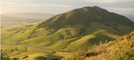
The fantasy transit map of the Bay Area I brought up on Wednesday had me thinking a fair amount about Marin's transit options.  Though we are typically the odd county out when it comes to fantasy transit improvements – though Napa certainly gets the short end of this particular map’s stick – Brian Stokle’s map adds two thoughtful improvements to the county’s transit system, and I think we’d do well to explore them, as well as a third.

I should mention that I appreciate the value of bus-only lanes to a degree, but in suburban settings it is sometimes better to mix them with three-person carpools as well.  In Northern Virginia, the casual carpool system functions as another transit system, vastly improving the efficiency of private cars and, therefore, the existing car-based infrastructure.  Mixing buses and cars isn’t always the best idea, but I think for Marin it makes perfect sense, both for political and practical reasons.

The 29R Rapid Bus

The 29R rapid bus line runs in a kind of loop between Fairfax, San Anselmo, Greenbrae, Larkspur Landing, the Canal, downtown San Rafael, Miracle Mile and finally back to the Hub, where I assume it would turn around.

Rapid bus isn’t the bus rapid transit (BRT) system that we’re used to hearing about – it doesn’t have its own lanes or stations.  Rather, the rapid bus concept functions as an express, limited stop bus with some structural changes beneath the surface, mostly to how the bus handles intersections.  These, along with high frequency (every 15 minutes, maximum), makes the bus a viable alternative against the car.  Even without the frequency improvements, adding speed to a bus line makes it less expensive to run and more attractive to potential riders.

The 29R route makes sense.  The Fairfax-San Rafael corridor is the county’s densest, and the narrow valley makes it well suited to a rapid bus line.  The Greenbrae stretch, though not nearly as dense, is an important transportation corridor, and building a rapid bus line here would serve populations that are otherwise left behind by SMART.  Greenbrae is also the kind of suburban strip that is easily converted to higher, more urbanist uses.

The drawback to a rapid bus line that it doesn’t have its own corridor.  Sir Francis Drake gets backed up during the morning rush between Fairfax and the Hub, as well as though Ross and near the Greenbrae Interchange, and a rapid bus shouldn’t be allowed to get stuck in that mire.  The same goes for Second Street in San Rafael.

To compensate, the 29R should be complemented with limited dedicated lanes.  Center, the old rail right-of-way between San Anselmo and Fairfax, might be re-purposed as a rush-hour bus and carpool lane.  It’s odd to imagine a surface street being carpool and bus only, but it would take a great deal of pressure off Sir Francis Drake and speed service along the corridor.  Yolanda and Landsdale Stations, the old light-rail stops, could be reactivated as bus stops.

Though we can’t do much about the Sir Francis Drake through Ross, the boulevard widens enough at College of Marin for dedicated lanes, though an initial segment of lanes should be built from El Portal Drive to the interchange.

The Canal’s traffic patterns are less familiar to me, but it is imperative the bus not travel the narrow streets in the neighborhood, sticking instead to the much wider and straighter roads closer to the freeway.  It’s close enough to the Canal that it will be accessible, but it will keep the bus moving fast enough to justify its “rapid” moniker.

The ultimate cost would likely be in the tens of millions, and building such a system will require more forward-thinking on development issues, but the ultimate reward would be much improved Central Marin circulation.

The 80R Bus Rapid Transit

Much more ambitious is the 80R Bus Rapid Transit (BRT) line, running from Santa Rosa to the Transbay Terminal.  Presumably, the line would have limited stop service on its own dedicated lanes for the whole trip, and would share the BRT lanes with other buses running along the corridor.  It would duplicate SMART’s service between Santa Rosa and Larkspur Landing, so I wouldn’t recommend building the line north of San Rafael.

A small portion of this line is already being built by SFMTA on Van Ness, which is getting its own dedicated lanes.  Presumably other streets will be similarly improved, but that’s just for San Francisco.  The Marin and Sonoma stretch will be extraordinarily expensive, involving rebuilt or widened freeway overpasses at minimum and possibly even new tunneling in the Marin Headlands.

The first portion of a BRT system is its dedicated lanes.  Ideally, these lanes will be permanently off-limits to private cars, and would certainly be off-limits to single-passenger only vehicles, and they would stretch along the entire length of the line.  This includes the stretch of freeway south of Marin City, which could mean some extremely expensive tunneling projects or a narrower freeway.  The Golden Gate Bridge itself would need dedicated bus lanes, which in theory would double the capacity of the bridge but would be politically challenging to build.

The other portion of a BRT system is its stops.  Like a train system, the stops would be located along the right-of-way; for the 80R, that would mean building new ramps directly between its lanes and freeway overpasses, where the BRT stations would be constructed.  Alternatively, passengers might board the bus at the freeway level in an enclosed station, and access would be provided from the street level.  These would be expensive as well, and the 80R would likely rival SMART in its costs.

Once finished, though, the system would be a transit lifeline for San Franciscans working north and North Bay residents working south.  As it stands,San Francisco’s Marin-bound buses leave only every hour or so in the morning, making transit commutes rather inconvenient.  BRT would need to run every 5-15 minutes to make the investment worthwhile, tying the City to the county in a way it has never been.

What’s Missing? BART

The missing piece is a strong connection from the Transit Center to the Richmond BART station and its Amtrak connections.  Though today the 40 and 42 buses don’t get a lot of ridership, building a rapid bus or BRT line with direct connections between San Rafael and Richmond would be a boon to Contra Costa County, one of the largest sources of Marin’s in-commuters.

A rapid bus line would start at the Transit Center and proceed along Francisco Boulevard, entering 580 at the bridge.  It would make a straight shot to the Richmond station and turn around, altogether taking 30-40 minutes.  A BRT line would run exclusively on the freeway, with its only stops being at Richmond, the Marin side of the bridge, and San Rafael.  Such a run would take about 20-30 minutes.

Though it would face the same challenges as the 29R and 80R, I like this route because it would provide easy transit between the Delta, the East Bay, and Marin while connecting Marinites with existing rail options the county doesn't have.  Given that the balance of commuting is East Bay to Marin, it might make more sense to build it as an AC Transit system, freeing Golden Gate Transit from making such a huge investment for residents outside its district.

In Sum

In sum, the two improvements, plus mine, are strong service improvements for Marin.  Other parts of Marin could use a rapid bus system similar to the 29R, especially the Mill Valley to Sausalito corridor.  Less plausible is a SMART service improvement, providing 30 minute headways all day, and even less would see the system double-tracked and electrified with 5-15 minute headways, which would likely require another ballot initiative.

Fantasy maps like Stokle’s aren’t meant to be entirely practical, of course – they’re meant to make us imagine what our cities can be like, and what they might be like if we ever get around to it transit improvements.  I’d like to see more of this – how about you?

Charge to Park, Not Ride

SausalitoTomorrow, the Golden Gate Bridge, Highway and Transportation District (GGBHTD) officials will debate whether to hike the cost of ferry rides for Clipper Card holders, which would raise $2 million to help close an $87 million deficit caused in part by costs associated with the Doyle Drive reconstruction.  As long as the parking lot is free, this is the wrong move for the District.  Charging for parking would discourage driving to the ferry terminal and encourage people to bus or carpool, freeing some of the parking lot for mid-day ferry drivers, putting more people on buses and bikes, and perhaps even boosting, rather than suppressing, ferry ridership.

Marin Transit or GGT should ensure there is a convenient bus transfer in Larkspur, however.  The 15 minute, freeway-bound walk from the nearest bus pad is sometimes called the Walk of Shame, and the 29 bus from either Ross Valley or the Transit Center is about as fast as molasses on a cold day.  Sausalito, also in the plan, doesn't fare much better with the bus route but at least its connections aren't equated with shame and embarrassment.

Transit-oriented redevelopment

Long-term, the GGBHTD should partner with the City of Larkspur to redevelop its Larkspur Landing parking lot as a transit-oriented village.  As it stands, it's about as far from Market Street, time-wise, as San Francisco's Inner Sunset neighborhood, and with the coming reconstruction of the Greenbrae Interchange and SMART station it stands to become the most transit-rich point in the County outside downtown San Rafael.

My very rough calculation, based on the findings of county-wide land values in the Tiburon Housing Element, places the parking lot's market value at between $48 million and $55 million, assuming 45-unit-per-acre housing.  If the land were leased from GGBHTD, it would add around $1 million to $2 million per year of direct income, and around $1.3 million in new fare revenue, assuming transit is the primary mode of transportation for the residents.  In all, it would equate to around 8% of the ferry's cost.

For Larkspur, it would provide a boon in sales tax revenue from tourists and residents alike.  Indeed, if density limits were lifted, the units would likely be studios or one bedrooms, too small to put a strain on the school system and the income would be a huge boon to town coffers.

But for the moment...

Parking lot development long-term conceptual thinking.  Tomorrow's vote is just about whether to raise the fares of ferry riders, and the answer should be a firm no.  Raising the price of parking would have a number of positive knock-on effects to commuting and parking patterns at both Sausalito and Larkspur by improving parking turnover availability for mid-day riders, while encouraging carpooling, biking, and busing, making more efficient use of the lots and the travel systems in place.

A Lesson in Overreaction

There’s an old saying: “Think local, act global.”  It’s a pithy reminder that everything we do, from our brand of toilet paper to how we structure our cities, effects everyone else. I think someone forgot to tell Corte Madera that.

This past Tuesday, Corte Madera voted to quit ABAG, effective July, 2013.  The Council voted out of frustration at housing mandates it says are killing the town’s character, out of anger at Plan Bay Area, and out of a belief that Corte Madera is perfect.  Yet its actions will have no effect on any of the issues at stake in this debate and will hinder the town’s capacity to shape those issues.

Corte Madera will still need to zone for more housing.  Although ABAG is the administrator of housing requirements for this region, the mandate to zone comes from the state government.  By leaving ABAG, Corte Madera will receive its mandates directly from Sacramento, exposing it to the whim of a truly unelected and unaccountable body.  Within ABAG, Corte Madera had a voice in the association’s General Assembly.  It could contest mandates, allocation formulae, assumptions, and more.  Although staff has a major role to play in governments across the region, at least ABAG staff worked for local elected officials and were answerable to them.

Beyond ABAG, Corte Madera is still a part of the other three regional organizations – Metropolitan Transportation Commission, Bay Area Air Quality Management District, and the Bay Coastal Development Commission – which are all working on Plan Bay Area.  Indeed, Corte Madera will be materially affected by decisions made by these agencies but will lack any voice at the proceedings, as it has no representative on any of their boards.

If Corte Madera is subject to SB375, it will need to work directly with staff at each of those regional agencies to formulate its greenhouse gas reduction plans, using up valuable regional and town staff time simply to duplicate efforts and wasting taxpayer money to do so.

Not that any of this will matter for a while.  Although details are a bit sketchy, it seems as though Corte Madera will still be subject to ABAG mandates for the upcoming housing needs allocation.  If you listened to media reports you’d never know it, but there will be no material difference to Corte Madera as a result of these actions.  The town will still be subject to Plan Bay Area and will still receive housing allocations from ABAG until the following allocation in 2020.

The straw that broke this camel’s back were preliminary draft growth projections being used in Plan Bay Area's discussion phase.  They were too high, a problem brought up with force at Tuesday’s council meeting, but ABAG heard the voice of the town and others and will revise its numbers significantly downward in the next draft.  Those original numbers were released with no methodology, another complaint of Corte Maderans, but ABAG will release its second draft methodology this month.  Housing allocation numbers for the next cycle haven’t even been drafted yet, but they were brought up time and again as though the town already knew it would need to zone for hundreds of new units.  These are fake problems ginned up by Corte Madera’s ABAG representative, Councilmember Carla Condon, who should be fighting within the system rather than railing against it.

So what did Corte Madera get with its resolution on Tuesday?  Headlines, extra costs, and a muted voice.  Corte Madera will still receive housing allocations from ABAG in 2013 and the state in 2020, it will still be subject to Plan Bay Area, it will still be under regional organizations, but it has forfeited its voice in any of these decisions and has thrust upon its staff state-mandated planning requirements currently performed by ABAG.  The council gets to look like a hero to the county’s paper progressives, but its petulant overreaction to nonexistent problems will only compound the town’s woes.

The SMART Area, Part 4: Buses, and the Future

Golden Gate Transit

Over the last few days I've been posting my impressions and comments regarding the San Rafael SMART Station Area Plan. It’s such a large, complicated, and potentially game-changing document that it needed more than just a single post. So far, we’ve covered land use and parking, and mobility, and this last post will cover buses the future of the site.

The hero of mobility in the Station Area Plan will not be SMART; it will be Golden Gate Transit. If a Sonoman wants to get to San Anselmo, she will likely go by bus. If a new resident in the Area Plan wants to go to San Francisco, he will go by bus. And if a Corte Maderan needs to get to Santa Rosa, she'll probably take a bus first. Yet, the bus system, as it stands, is widely lamented as inadequate, especially on weekends. How to improve long-range (beyond 2 miles) mobility for residents in and through the area, and how to accommodate the increased service in the study area, should certainly be part of the conversation.

The typical Marin bus route runs every 30 to 60 minutes and is far slower than driving an equivalent distance thanks to a few crazy loops, some too-compact stop densities, lack of signal priority, long stop layovers, and the general restrictions of running on surface streets in traffic. Although there is an effective and complicated transfer system, thanks to a 95% on-time rate, the bus as it currently stands is not a car-replacing transit system.

This bodes ill for transit-oriented development in the Plan Area, not to mention other towns that want to orient their ABAG zoning towards transit – essentially the whole of Marin except for Novato. Without an adequate framework, increased population will lead to more sprawl, meaning more traffic, more pollution, and less open space. We must make the bus work.

There's a debate in the activist community regarding how exactly to do that, but it comes down to a few priorities: improve the absolute quality of the bus service through frequency, improve the relative quality of the bus service by making cars a less attractive choice, and improve the efficiency of rider collection by putting residents and jobs near the stations. In the ideal this means bus rapid transit or just separated lanes, but in Marin's medium-term, such BRT lines on the old rail rights-of-way are probably politically infeasible, and auto mode share would likely remain too great to support the service. Express buses, however, make perfect sense.

Whenever I ride GGT, I hardly see any on-and-off boarding between major stations; people are going from center to center, and ridership is not evenly distributed along the route. GGT should acknowledge this and operate a high-frequency town-to-town express network. GGT's last semi-comprehensive system analysis showed that such express service, combined with developing a system of “green hub” transfer points, would benefit a huge number of riders. If marketed with SMART – a rubber-tire rail – GGT could have a success and draw riders out of the new developments along the SMART corridor.

To boost ridership more generally, GGT should mail every adult within a half-mile radius of the Transit Center a pre-loaded Clipper card with a year-long GGT unlimited ride pass, perhaps in conjunction with the proposed Zipcar membership. San Rafael should allow local businesses to cash-out of some parking requirements by purchasing annual transit passes for their employees. Boulder did something similar to these proposals and saw drive-alone rates drop from 56% to 36%, with the bus taking up the slack. Give people something of value, and they will respond.

The Area Plan makes no mention of improving overall bus capacity or promoting ridership, but it does make some recommendations on how to move the Bettini Transit Center to the SMART site. None of the proposals struck me as particularly attractive, as most of them involve transforming the blocks around the SMART station into rather pedestrian-unfriendly surface stations akin to the Bettini Transit Center today. Other proposals, such as putting bus bays along Heatherton and under the freeway are more attractive from a pedestrian perspective but offer limited capacity.

If San Rafael decides it needs a new parking garage west of 101, the bus terminal should be located to the ground level, giving riders a more weatherproofed facility and allowing the height above the terminal to be used effectively. Bettini's lack of developability is one of the major arguments in the Area Plan for its demolition, so the city should try to lump its desired but ugly infrastructure together. Using the example diagrams from the Area Plan, such a garage would likely provide between 10 and 20 bus bays, depending on the configuration and location of the garage.

The Future

SMART is coming to town, whether people want it or not, and with it will hopefully be a new neighborhood and a new swagger for San Rafael. The city has a chance to come to the forefront of urban policy in the North Bay through innovative (for Marin) land use practices like form-based zoning, parking minimum reform, and true transit-oriented development. Until now, these have simply been words in general plans and housing elements, but San Rafael may actually make it happen. The opportunities here should excite everyone who supports a more walkable, livable, and sustainable Marin.

That's not to say there aren't challenges. Parts of the city staff have a history of choosing car capacity over pedestrian-friendliness, and powerful organizations such as the San Rafael Neighborhood Association could still throw their weight against passage. Both impulses should be resisted by the Council. The opportunities are too great to let this plan slip by.

The Citizens Advisory Committee is meeting on February 2 at 7pm in San Rafael's Community Development Conference Room. The draft plan will go before the City Council some time in March. The Greater Marin will likely be back to its regularly scheduled programming Wednesday.